| ©The Archaeological Settlements of Turkey - TAY Project | ||||||
|
|
||||||
Yumuktepe |
||||||
|
|
||||||
| Ages | Maps | Photos | ||||
| Neolithic Chalcolithic EBA IA 14C |
 |
 |
||||
|
|
||||||
|
Type:
|
Mound | |||||
|
Altitude:
|
150 m | |||||
|
Diameter:
|
m- Direction: | |||||
|
|
||||||
|
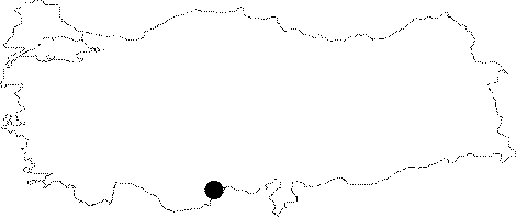
Region:
|
Mediterranean | |||||
|
Province:
|
Mersin | |||||
|
District:
|
Merkez | |||||
|
Village:
|
Merkez | |||||
|
|
||||||
|
Destruction :
|
Contemporary Settlements | |||||
|
|
||||||
|
TAYEx:
|
Visited - 14/7/2001 | |||||
|
|
||||||
|
Registration State:
|
For detailed registration information please refer to Turkish pages. | |||||
 |
||||||
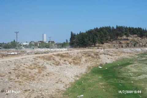
| Location: This site lies approximately 3.5 km west-northwest of the city of Mersin; along the major highway heading west from the city. Since the city has grown; the site now lies in the Demirtas neighborhood and looks more like a park or picnic area than a mound. |
| Geography and Environment: The 25 m high mound lies on the southern bank of the Soguksu (Müftüderesi) Stream. The site has a 300 m diameter and covers a 12 hectare area. Although the Department of Monuments and Museums has declared this site as a protected historical area; it has been turned into a park and trees have been planted. The western part of the mound has been eroded by the flooding of the Soguksu Stream. Although the mound was originally called Yümüktepe; this name has been changed to Yumuktepe; as it is the name that the local villagers use to refer to the site. In addition; there are many archaeological publications that refer to this site as Mersin or Mersin Soguksutepe. |
| Destruction Details: The mound is being used as a picnic area today [TAYEx 14.7.2001]. |