|
©The Archaeological Settlements of Turkey - TAY Project
|
|
|
|
|
|
Yumuktepe |
|
|
For site maps and drawings please click on the picture...  |
For photographs please click on the photo... 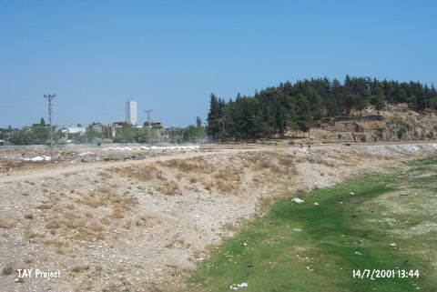 |
|
Type:
|
Mound |
|
Altitude:
|
150 m |
|
Region:
|
Mediterranean |
|
Province:
|
Mersin |
|
District:
|
Merkez |
|
Village:
|
Merkez |
|
Investigation Method:
|
Excavation |
|
Period:
|
|
|
|
|
 |
|
| Location: This site lies approximately 3.5 km west-northwest of the city of Mersin; along the major highway heading west from the city. Since the city has grown; the site now lies in the Demirtas neighborhood and looks more like a park or picnic area than a mound. |
| Geography and Environment: The 25 m high mound lies on the southern bank of the Soguksu (Müftüderesi) Stream. The site has a 300 m diameter and covers a 12 hectare area. Although the Department of Monuments and Museums has declared this site as a protected historical area; it has been turned into a park and trees have been planted. The western part of the mound has been eroded by the flooding of the Soguksu Stream. Although the mound was originally called Yümüktepe; this name has been changed to Yumuktepe; as it is the name that the local villagers use to refer to the site. In addition; there are many archaeological publications that refer to this site as Mersin or Mersin Soguksutepe. |
| History: |
| Research and Excavation: The mound was discovered in 1936 by J. Garstang; who conducted excavations at the mound from 1937-39 and 1947-48. Many well-known scientists and archaeologists joined these first excavations at the site. Among them were S. Lloyd; R.D. Barnett; M.V. Seton-Williams; O. Gurney and G. Childe. Excavations at the site have resumed since 1993 under the direction of the Mersin Museum and since 1994 under the direction of Veli Sevin of the University of Istanbul; Department of Ancient History and I. Caneva of the University of Rome; La Sapienza. These excavations have determined the limits of the mound and have attempted to turn the site into an open-air archaeology museum. They hope to expose the architecture of the various levels in a large step trench and restore necessary structures. Thus; the visitors will be allowed to see the cultural development at the site throughout the different periods. Sevin and Caneva agreed first to test Garstang's stratigraphy with modern technology and see whether new results could be obtained. The project is expected to continue for a very long time. In 1994; a trench was opened immediately east of Garstang's Trench A in order to check the accuracy of Garstang's results; another trench was opened further south. Sevin notes that many new occupational phases were discovered. |
| Stratigraphy: As the late period excavations were mainly concerned with the Neolithic and Chalcolithic Ages; there is no difference in the stratification of the EBA. During the excavations under J. Garstang; 33 layers from the Neolithic Age to the Islamic Period were identified [Garstang 1953:chronology table; 2]. Among them; level XII A is dated to EBA I. Finds expose that it is a poor settlement. The EBA II-III settlement is claimed to be demolished by erosion. Level XII A is represented by a thin cultural deposit between 16.8 and 17.4 m below the zero level of the mound. |
| Small Finds: Architecture: The western trench yielded 1 m thick mudbrick walls belonging to the level XII A below the structures with stone foundations of level XI dated to the Colony Period [Garstang 1953:fig.117;pl.XXVIII]. It is noted that the walls built of big sized mudbricks constitute four-cornered rooms. As they were brought to light in a very small area; it is difficult to define a general construction plan. The compactness of the cultural deposit belonging to this level exposes the presence of a short lasting settlement. The floors are observed to be of compressed clay as it is the case in rooms' no. 111 and 112. The architectural remains of the settlement belonging to EBA II-III which could have been identified by the pottery finds only during the excavation were not identified on the western section of the mound. They should be explored in the other sections. Pottery: Two groups of ware were found in level XII A. First; white painted and burnished ware on black or dark gray-black wash. As decoration; line groups parallel to each other; chevron and twisted lines were applied. White pigment paints were applied. Standard forms of this ware produced elaborately are observed. The most common form is a bell shaped vessel with a high foot and an out-rolled rim. It looks like big goblets [Garstang 1953:pl.XXVIIb]. Also found are footless and deep bowls [Garstang 1953:fig.118/ 11-17]. The second group of ware; similar to this one; is simple; gray and black washed ware. This ware; employed in the forms of the first group; was also used for various vessels like jug; saltcellar; horned cup and miniature cup; etc. [Garstang 1953:fig.119]. Pottery recovered from the bottom of the trench X on the west and from the pits as scattered around was dated to the second half of the third millennium BC by Garstang. Their relation to the architecture remains unclear. Garstang compares them with the other EBA settlements of Anatolia [Garstang 1953:194-197; fig.124-127]. The presence of metallic ware samples of Central Anatolia [Mellaart 1963:fig.6] and vessel forms of Western Anatolia exposes the interaction between these regions during that period [Garstang 1953:fig.122;124]. Spouted pitchers are produce of metallic ware; their rims and handles decorated with painting. Other: It is amazing to see that no information was provided about the small finds of the level XII A and the level supposed to exist above it. Among the metallic finds of level XI there are finds datable to EBA III. |
| Remains: |
| Interpretation and Dating: It is interesting that Mersin Yumuktepe was not occupied heavily during EBA compared to the other ages. Probably the insufficiency of the area excavated resulted in such a conclusion. The level XII A dated from 2900 and 2500 BC by Garstang indicated the presence of probably two-storey buildings with its thick mudbrick walls. It is definite by the settlements of Büyük Güllücek and Kaledorugu that the white painted ware on a dark background came from the east and expanded to the Black Sea region. The vessels of this ware were found at Firaktin; Karaoglan Höyügü and Kusura in Central Anatolia. Both this level and the level supposed to exit between XII A and XI and represented by pottery finds only expose; in fact; the presence of significant EBA settlements. It can be considered that this settlement was probably destroyed by the upper settlement of the second millennium BC. The excavation of the level belonging to this period will illuminate such presumptions. |