|
©The Archaeological Settlements of Turkey - TAY Project
|
|
|
|
|
|
Yumuktepe |
|
|
For site maps and drawings please click on the picture... 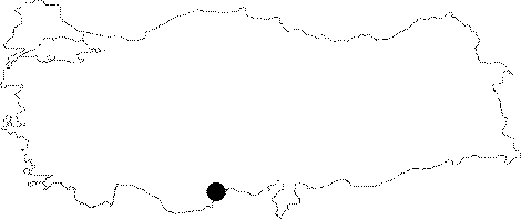 |
For photographs please click on the photo... 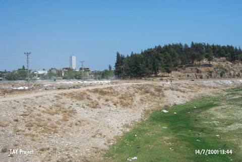 |
|
Type:
|
Mound |
|
Altitude:
|
150 m |
|
Region:
|
Mediterranean |
|
Province:
|
Mersin |
|
District:
|
Merkez |
|
Village:
|
Merkez |
|
Investigation Method:
|
Excavation |
|
Period:
|
Ceramic |
|
|
|
 |
|
| Location: This site lies approximately 3.5 km west-northwest of the city of Mersin; along the major highway heading west from the city. Since the city has grown; the site now lies in the Demirtas neighborhood and looks more like a park or picnic area than a mound. |
| Geography and Environment: The 25 m high mound lies on the southern bank of the Soguksu (Müftüderesi) Stream. The site has a 300 m diameter and covers a 12 hectare area. Although the Department of Monuments and Museums has declared this site as a protected historical area; it has been turned into a park and trees have been planted. The western part of the mound has been eroded by the flooding of the Soguksu Stream. Although the mound was originally called Yümüktepe; this name has been changed to Yumuktepe; as it is the name that the local villagers use to refer to the site. In addition; there are many archaeological publications that refer to this site as Mersin or Mersin Soguksutepe. |
| History: |
| Research and Excavation: The mound was discovered in 1936 by J. Garstang; who conducted excavations at the mound from 1937-39 and 1947-48. Many well-known scientists and archaeologists joined these first excavations at the site. Among them were S. Lloyd; R.D. Barnett; M.V. Seton-Williams; O. Gurney and G. Childe. Excavations at the site have resumed since 1993 under the direction of the Mersin Museum and since 1994 under the direction of Veli Sevin of the University of Istanbul; Department of Ancient History and I. Caneva of the University of Rome; La Sapienza. These excavations have determined the limits of the mound and have attempted to turn the site into an open-air archaeology museum. They hope to expose the architecture of the various levels in a large step trench and restore necessary structures. Thus; the visitors will be allowed to see the cultural development at the site throughout the different periods. Sevin and Caneva agreed first to test Garstang's stratigraphy with modern technology and see whether new results could be obtained. The project is expected to continue for a very long time. In 1994; a trench was opened immediately east of Garstang's Trench A in order to check the accuracy of Garstang's results; another trench was opened further south. Sevin notes that many new occupational phases were discovered. |
| Stratigraphy: The stratigraphy as determined during the excavations conducted by Garstang are as follows (from earliest to latest): XXXIII-XXVII: Early Neolithic Period XXVI-XXV: Late Neolithic Period XXIV: Proto-Chalcolithic Period XXIII-XX: Early Chalcolithic Period XIX-XVI: Middle Chalcolithic Period XV-XIIb: Late Chalcolithic Period XIIa: Early Bronze Age X-IX: Early Hittite Period VIII-V: Neo-Hittite Period IV-I: Late Hittite-Islamic Period Garstang's excavations reached the Yumuktepe Neolithic layers in three different parts of the mound: A; B and C. Although trench A was excavated to a depth of 50 cm beneath the level of the modern plain; virgin soil was not reached. No report can be given on the stratigraphy being determined in the new phase of excavations led by Sevin and Caneva because they are still in early stages of excavation. |
| Small Finds: Architecture: Layers XXXIII-XXVII: The earliest settlers who came to the site of Mersin Yumuktepe lived in houses with foundations constructed with pebbles collected from the Soguksu Stream. Since no clay was found between the stones; it is believed that the stones were dry lined. The walls of these structures are believed to have been 50 cm thick. The houses probably had one story. The roofs were made of reed and twig bundles attached to a wooden frame. No exact house plans could be determined. The 1994 excavations led by Sevin yielded 27 occupational phases dating to this period. Even the earliest occupational phases of this period yielded charcoal and straw lined floors. In 1996 remains of a stone foundation with superimposed pisé walls and woven reeds branches were found immediately beneath Garstang's Layer XXVI (probably Layer XXVII). Sevin and Caneva assign this structure to the Aceramic Neolithic Period. Layers XXVI-XXV: The architectural remains found in Layer XXVI of Garstang's excavations have been well described. Here rectangular and trapezoidal buildings; each with a long passage way and two or three rooms on either side; have been found. The long passage leads to a courtyard. Construction is a dry wall technique where two rows of pebbles are placed together. The fact that there are no doorways suggests that entrances to these structures may have been from the roofs. It is believed that the stone walls were completed with mudbricks on the top part. The structures here are very different from most other Anatolian ones of this period. It is difficult to get an exact plan of the structures since the trenches in which these structures were exposed were very small. During 2002 season excavations the way of the solid wall belonging to the second phase of Late Neolithic was specified at the eastern part of the trench. The stone structure rising on a wide stone pedestal was built by mudbricks on both sides of a stone line. It was observed that the wall was curved to the north with right angle and then cut by a wide and vertical trench. This trench is Garstang's trench X; which could not be found in previous years. The lower layer reached here was defined as the group of stone paved silo floors by Garstang; and seemed to be covering the wall in this trench too [Caneva-Köroglu 2004:492]. Architectural characteristics of each sub-phase relating to the Neolithic layers were determined during the excavations that took place in 2002. Wattle and daub for the earliest phase of Neolithic for which no foundation could be found; multi-room buildings on stone basis for the mid Neolithic; rectangular stone foundation buildings with apse for the Late Neolithic; and massif stone walls for the Late Neolithic [Caneva-Köroglu 2004: 493]. During the researches in 2003 except for the earliest phases of settlement; all Neolithic layers that were unearthed in the northwestern area were re-evaluated as new trenches. In Yumuktepe inside the settlement identified as the latest phase stone paved silo floors were revealed on the spaces among the houses. But these floors interrupted the stratigraphical continuity of the layers [Caneva 2004:58-62]. Stone foundations of a wall dating to Mid Neolithic Period and on the exterior side of this foundation a stone pavement made with small stream pebbles were revealed in the final layer before the declination of the northern slope during the 2005 researches on the large area northwest of the mound; just at the bottom of the excavated area in E5 section; which belongs to Late Neolithic Period. Burnt material and Late Neolithic Period soil base were found in a section further north at the same level. This area is especially important to figure out the stratification relationship between the two phases. As a result of the researches at that section it was found that the Mid Neolithic Period settlement was not interfered by the Late Neolithic Period layers; but the settlement was spreaded in a similar manner to the slope declination in that area [Caneva et al. 2007:670]. Although no architectural remains were coincided in the F6 area where the Late Neolithic Period embankments were dug; the locations of warehouses were identified by the pavements made by flat stream pebbles. It was found that one of those was not prepared by digging a pit but by constructing a circular wall around it [Caneva et al. 2007:670-671]. In 2006 excavations; Middle Neolithic phase; the settlement started to include terraced areas on the edges of the main dwelling areas. No real architecture was found in this marginal area; except for containing walls flanked by storage and garbage pits. In the second excavation unit; Later Neolithic phases in the same north-western area were also damaged. The Late Neolithic area contained an impressive concentration of stone-paved silo structures; in the spaces between the apsidal houses. Most of these structures were constructed with a pisé wall supported by an outer stone lining; all were paved with river pebbles. This kind of storage structure was never found in the earlier levels. As for the Final Neolithic phase; above the apsidal houses; excavations focused on the area of the pebble-paved road which climbed up the slope; where post holes indicated the presence of light structures. The deposits consisted of thin layers of alternating ashes and clayey soil; with no solid structures. This peculiar stratigraphy; coupled with the concentration of potsherds and bone fragments; as well as of antler and stone artefacts; such as shafts; beads and bracelets; suggests taht this was a dumping area used for specialised workshops. The wear trace analysis on the obsidian implements from this area seem to confirm this interpretation; revealing traces of intensive stone and bone working. Child graves were found scattered between the structures. The child grave found this year was accompanied only by a necklace made with different types of disk stone beads. A small dog burial was also found in this level [Caneva-Köroğlu 2008:383]. In 2007, as for the Final Neolithic phase, excavations were carried out east of the pebble-paved road which climbed up the slope, in the area where light workshop structures were identified in the previous campaign. Below these structures, in the phase of the Late Neolithic apsidal houses, the area contained and impressive concentration of stone-paved silo structures, built close to one another in the spaces with a pisé wall, some of them supported at the base by a ring a stones; all were carefully paved with flat river pebbles, and plastered. This kind of storage structure has never been found in the earlier levels and is now recognised as a peculiar feature of this phase [Caneva-Köroğlu 2009:159]. In the Middle Neolithic phase was represented in this area only by terraces and storage and/or garbage pits deeply cut into the earlier deposits. This suggests that these were marginal spaces, at the edges of the main dwelling areas. [Caneva-Köroğlu 2009:156]. Pottery: Layers XXXIII-XXVII: The lower levels at Yumuktepe yielded Coarse Wares; Dark Burnished Wares/Fine Wares and other ceramics during Garstang's excavations. The coarse wares were found at an elevation of 6-7 m; approximately corresponding with Layers XXVIII-XXVII. This ware can also be found in even earlier layers at the site. It is usually chaff tempered but sand and grit temper is also used. The ware; classified as kitchen ware; is poorly fired and has a gray core. The interior surface of the vessels has been hand-smoothed. The surface color is mostly light brown. The oldest ceramics at Yumuktepe are poorly fired wares between the elevation of 6 and 6.5 m and the crumbly coarse wares at 4 m elevation. Other ware types found in the Early Neolithic layers at Yumuktepe are the Fine Wares and the Black Burnished wares. These include closed or nearly closed vessels with globular bodies. During 2002 season excavations in Early Neolithic trench on the northwest slope of the mound; no architectural remains were uncovered; but in situ finds with impressed decoration and brown burnish were found [Caneva-Köroglu 2004:491]. In 2007 excavation; the Final Neolithic the pottery is light colored, decorated with red or brown painted motifs [Caneva-Köroğlu 2009:156]. The Middle Neolithic pottery included DFBW and large light-orange undecorated globular containers, with extremely thin walls in spite of the coarse grit ware [Caneva-Köroğlu 2009:156]. Layers XXVI-XXV: Coarse wares continue in this phase. No difference in paste and firing techniques has been observed. The surface colors are usually gray or brown. The outer surfaces of the wares have been incised with sharp tools; sea-shells; or the potter's nails. These decorations are symmetrical and have been lined in vertical rows (or nail-print-like slightly rounded lines) around the vessels. Many sea-shells were found in the layers where incised decorated vessels were found; suggesting that they may have been used for this purpose. At the end of the Late Neolithic; coarse wares increase while Dark Burnished Wares are most common in Layer XXVII. At an elevation of 7.5 m; incised decorated examples of this carefully burnished ware begin to appear. Also at this level; another type of dark burnished ware with grayish black inner surfaces and well burnished black outer surfaces is found. Again closed vessels with globular bodies dominate; but bowls are present. Painted wares appear in Layer XXVII [Garstang 1953:39]. Layer XXV; assigned to the Proto-Chalcolithic by Garstang; yielded a grit and coarse sand tempered ware with thick or thin cream-colored slip and red or brown painted zigzag decorations. The researches at the Early Neolithic trench in 2006 revealed fragments of a chest made of straw tempered clay which was hardened due to the fire it went through. This layer also revealed examples of thin; brown; hemispheric earthenware pottery [Köroğlu 2007:37-41]. Chipped Stone: Both obsidian and flint stone tools were found. The tools in the upper levels of the Early Neolithic resemble contemporaneous types from Central Anatolia. Very few obsidian perforators and points have been found. Ground Stone: Small celts have been found. Bone: There is a tool with a harpoon-like point among the bone tools of early phase of Late Neolithic [Caneva-Köroglu 2004:492]. Human Remains: Sevin and Caneva found two child burials in the upper Neolithic Layers; probably XXVI-XXV. One of these was in flexed position and placed in a 50 cm deep pit. The burial gifts included a small white bead necklace and a globular bodied vessel with painted zigzag and lightning motifs. The grave-goods found in the other burial include agate; turquoise and other semi-precious stones; as well as bone and shell beads. The excavations inside the Late Neolithic layer in 2006 revealed two burials out of which one was the skeletton of a small child. There is a necklace and a bracelet inside the burial left as burial gifts; which were made of hundreds of beads in different colors [Köroglu 2007:37-41]. Flora: The negative traces of domesticated wheat spikelets were coincided on a ball of mud which may be part of a woven tree branch of a building that belongs to the Middle Neolithic Period; on the area inside the building phases at the northwest of the mound in 2005 [Caneva et al. 2007:671]. In 2006 excavations; botanical analyses revealed that the most intensively used domestic cereal was triticum monococcum (80%). Different kinds of legumes (lentils; peas and bitter vetch) and fruits; such as olives; figs and pistachios; were also used. In 2007, botanical analyses revealed that the most intensively used domestic cereal in this early Neolithic phase was triticum monococcum (80%). Different kinds of legumes (lentils, peas and bitter vetch) and fruits, such as olives, figs and pistachios, were also used [Caneva-Köroğlu 2009:157]. Bone; antler: During the excavations that were performed inside the Late Neolithic Layer in the year 2006; a feline skeletton was unearthed out of a pit which was primarily thought to be a burial. Compared to the well-known example from Cyprus it may be one of the first domesticized cats [Köroglu 2007:37-41]. Except for a few fish bones; hunting activities were; as previous campaigns had revealed; almost absent in these early phases; in which animal food was entirely provided by domestic animals; cattle; caprovines and pig. Goat was much more abundant than sheep; suggesting that wool was not yet considered a valuable item [Caneva-Köroglu 2008:382]. Other: A press-on seal made of a pebble was found; with a plus sign catved on it on the area inside the building phases of the Late Neolithic Period at the northwest of the mound in 2005 [Caneva et al. 2007:671]. In 2007 excavations, except for a few fish bones, hunting activities were, as previous campaigns had revealed, almost absent in these early phases, in which animal food was entirely provided by domestic animals, cattle, caprovines and pig. Goat was much more abundant than sheep, suggesting that wool was not yet considered a valuable item. The high frequency of pigs at Yumuktepe, compared with other Neolithic settlements in the Near east, suggest that the environment around the site was damp, a hypothesis supported by the presence of water mouse [Caneva-Köroğlu 2009:157]. |
| Remains: |
| Interpretation and Dating: Mersin Yumuktepe was a key site in the archaeological world during Garstang's excavations. Garstang's stratigraphy is slightly different than Burkitt's. It is therefore necessary to wait for the results of the current excavations conducted at the mound by Sevin and Caneva. The ware with lightning motifs assigned to the Late Neolithic Layer XXVII by Garstang is very similar to the Early Chalcolithic ware found at Can Hasan. Such wares; when found in Cilicia; have been assigned to the end of the Late Neolithic and the beginning of the early Chalcolithic Period. In ASPRO Garstang's Layers XXXIII-XXVIII were placed in Early Neolithic phase 5; Layer XXVII were placed in late Neolithic phase 6/1; layers XXVI-XXIV was placed in Proto-Chalcolithic phase 6/2 [Hours et al. 1994:237]. Sevin and Caneva; on the other hand; prefer to assign Layers XXXIII-XXIX to the Early Neolithic and Layers XXVVII-XXVI to the Late Neolithic Period. Although not definite; Layer XXVII is now believed to be Late Neolithic [Sevin-Caneva 1996:78-79]. A 14C sample taken in 1993 by Sevin and Caneva from 80 cm beneath Garstang's Layer XXX dated to 7920±90 BP; which is approximately 6785-6620 BC [Sevin-Caneva 1995:32-33]. Defining the correlation between former and latest excavations would be easir by the discovery of Garstang's trench X during 2002 season [Caneva-Köroglu 2004: 493]. There are no traces of any usage of stone foundations; or adobe bricks on the buildings which went through big fires within the Neolithic layers. Although not completely determined the fragments of clay and plaster show that the buildings were constructed by a technic such as in a "Hut house" [Köroglu 2007:37-41]. Several layers of the long Neolithic sequence have been exposed in these last years in quite an extensive area (about 50 sq m) in squares D3, E3 and F3, uncovering traces of various kinds of structures, shelters, storage pits and areas for occasional outdoor activities . In 2009, remains of more complete wattle and daub structures were excavated in the Early Neolithic levels. One such structure, A201, consisted of the bottom of a round plan hut, partially sunken in the soil. Heaps of burnt crumbled mud fragments were discovered in the filling of the hut. A preliminary examination identified fragments from wall, roof and floor plaster, as well as from unfired clay containers. A concentration of pebbles in a light oval pit inside the perimeter of the hut probably comprised the preparation of a hearth. Other pebble concentrations uncovered in the surrounding areas seemed to delimit the contour of lighter constructions, possibly consisting of shelters for workshops. The most characteristic pottery from these contexts consisted of few thin-walled, brown, burnished hemispherical cups, sometimes bearing impressed decoration around the mouth. Among the most important findings from these areas were two large stamp seals, or pintaderas, one of which was made out of a thick bone, the other out of a soft grey stone, both bearing quite complex geometric motifs incised on the flat surface, and a perforated handle on the back. The last 14C measurements confirmed the expected date of 6445 Ğ 6240 cal. BC for this architectural level. These stamp seals are therefore among the earliest ever found and might reflect a form of collective storing, perhaps related to seasonal transhumance. In 2010, another dwelling structure emerged in the deepest exposure. It is a circular structure that is about 3 m in diameter, is partially sunken in the soil and has a burnt filling. The living area around the hut was scattered with circular concentrations of pebbles and plastered areas that probably reflect areas used for some form of domestic activities. Although the hut has not yet been excavated, it is clearly visible in the stratigraphic section on the eroded side of the mound. The earthen walls of the pit appear to be reinforced with a stone lining, while the emerging wattle and daub structure is burnt and collapsed both within and all around the hut pit. A thick floor scattered with carbonised grains is also visible in the section. Dug deeply into these early deposits were also much later pits belonging to a Late Neolithic graveyard that extended as far as a terraced area that lies at a much lower elevation than the core of the Late Neolithic settlement. Another human burial was found in 2009 in one of these terraces that were cut into the Early Neolithic deposits. The not very well preserved skeleton found in this burial lay in a tightly contracted position, with gifts comprising a group of different-sized pottery vessels, with a light-coloured surface and decorated with red or brown painted motifs. Preliminary anthropological observations revealed that the skeleton belonged to a middle aged woman affected by osteoarthritis of the spine. Use wear traces on the surface of the teeth revealed that they had been intensively used in basketry making. The body of another adult individual was found in 2010. The robust skeleton, probably belonging to a man, lay on its right side, in a contracted position, hands to face. No grave goods accompanied the dead, though large stones were scattered over the body. Another grave, containing an infant skeleton, again with no accompanying gifts, was found on top of this burial [Caneva-Köroglu 2013.217-219]. |