| ©The Archaeological Settlements of Turkey - TAY Project | ||||||
|
|
||||||
Dereagil |
||||||
|
|
||||||
| Ages | Maps | Photos | ||||
| Chalcolithic EBA IA |
 |
 |
||||
|
|
||||||
|
Type:
|
Mound | |||||
|
Altitude:
|
525 m | |||||
|
Diameter:
|
m- Direction: | |||||
|
|
||||||
|
Region:
|
Black Sea | |||||
|
Province:
|
Amasya | |||||
|
District:
|
Suluova | |||||
|
Village:
|
Yüzbeyi | |||||
|
|
||||||
|
Destruction :
|
Illicit Digging - Contemporary Settlements - Attention | |||||
|
|
||||||
|
TAYEx:
|
Visited - 23/8/2003 | |||||
|
|
||||||
|
Registration State:
|
For detailed registration information please refer to Turkish pages. | |||||
 |
||||||
| Location: |
| Geography and Environment: |
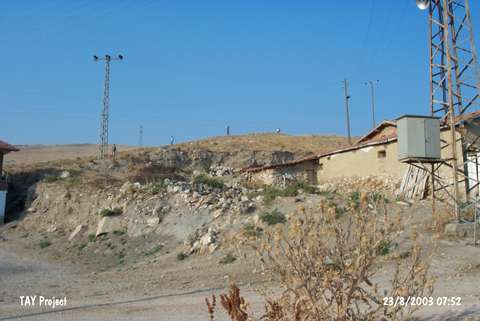
| Destruction Details: The mound has been damaged due to contemporary settlements and illicit diggings. Village houses have been built on the north-northeastern skirts and a road passes over it. Electricity poles have been located on the top and skirts. Illicit pits were observed on the upper section [TAYEx 23.8.2003]. |