| ©The Archaeological Settlements of Turkey - TAY Project | ||||||
|
|
||||||
Turgut / Lagina |
||||||
|
|
||||||
| Ages | Maps | Photos | ||||
| EBA IA Greek-Roman |
 |
 |
||||
|
|
||||||
|
Type:
|
Cemetery | |||||
|
Altitude:
|
420 m | |||||
|
Diameter:
|
m- Direction: | |||||
|
|
||||||
|
Region:
|
Aegean | |||||
|
Province:
|
Mugla | |||||
|
District:
|
Yatagan | |||||
|
Village:
|
Turgut | |||||
|
|
||||||
|
|
||||||
|
|
||||||
|
TAYEx:
|
Visited - 26/9/2000 | |||||
|
|
||||||
|
Registration State:
|
Registered For detailed registration information please refer to Turkish pages. | |||||
 |
||||||
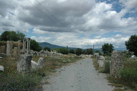
| Location: It is located; 10 km northwest of Yatagan district; 1 km away from Turgut; 15 km northwest of the Yatagan District of the Mugla Province. It is 9 km far from the ancient city of Stratonikeia [Tırpan 1996:209]. It is reported that it was formerly known as Leyne in the archaeological literature until 1979 [Boysal 1979:389]. |
| Geography and Environment: It is located on a fertile land in the Valley of the Cine Brook [Boysal 1979:389]. |
| Destruction Details: |