|
©The Archaeological Settlements of Turkey - TAY Project
|
|
|
|
|
|
Turgut / Lagina |
|
|
For site maps and drawings please click on the picture...  |
For photographs please click on the photo... 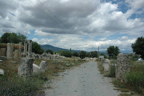 |
|
Type:
|
Cemetery |
|
Altitude:
|
420 m |
|
Region:
|
Aegean |
|
Province:
|
Mugla |
|
District:
|
Yatagan |
|
Village:
|
Turgut |
|
Investigation Method:
|
Excavation |
|
Period:
|
EBA II |
|
|
|
 |
|
| It lies east of the ancient Lagina settlement; Turgut with its modern name; about 10 km northwest of Yatagan District of Mugla Province. The EBA cemetery is situated on a lowland of one of the capes extending like peninsula and descending towards the valley of the Çine Stream where the ancient city is located. The place where the cemetery is located is known as Yarbasi. It has been damaged due to heavy cultivation. It was discovered in 1969 by Y. Boysal. The excavations and survey yielded pithos graves in 40-50 m depth probably dating to the EBA. Almost all of the graves have been disturbed. Majority of the graves faces the east. They were all capped by big flat stones. Some house more than one burial. Y. Boysal reports that the graves were severely damaged and no finds were recovered. It is a good example for the cemeteries demolished by the treasure hunters in Western Anatolia. It takes place in the registered archaeological sites list prepared by Ministry of Culture and Tourism. |
| Location: It is located; 10 km northwest of Yatagan district; 1 km away from Turgut; 15 km northwest of the Yatagan District of the Mugla Province. It is 9 km far from the ancient city of Stratonikeia [Tırpan 1996:209]. It is reported that it was formerly known as Leyne in the archaeological literature until 1979 [Boysal 1979:389]. |
| Geography and Environment: It is located on a fertile land in the Valley of the Cine Brook [Boysal 1979:389]. |
| History: |
| Research and Excavation: |
| Stratigraphy: |
| Small Finds: |
| Remains: |
| Interpretation and Dating: |