| ©The Archaeological Settlements of Turkey - TAY Project | ||||||
|
|
||||||
Karkamis |
||||||
|
|
||||||
| Ages | Maps | Photos | ||||
| Neolithic Chalcolithic EBA IA |
 |
 |
||||
|
|
||||||
|
Type:
|
Mound | |||||
|
Altitude:
|
370 m | |||||
|
Diameter:
|
m- Direction: | |||||
|
|
||||||
|
Region:
|
Southeastern Anatolia | |||||
|
Province:
|
Gaziantep | |||||
|
District:
|
Karkamis | |||||
|
Village:
|
Barak | |||||
|
|
||||||
|
|
||||||
|
|
||||||
|
TAYEx:
|
- | |||||
|
|
||||||
|
Registration State:
|
Registered For detailed registration information please refer to Turkish pages. | |||||
 |
||||||
| Location: The site of Karkamis/Carchemish lies southeast of the city of Gaziantep; approximately 30 m south of the town of Nizip; at the Turkish-Syrian border; between Barak and Cerablus (Jerablus). |
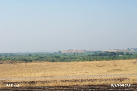
| Geography and Environment: The site; which lies on the western bank of the Euphrates River; has an important location because it lies on major trade routes. The site is approximately 900x900 m in size. |
| Destruction Details: |