|
©The Archaeological Settlements of Turkey - TAY Project
|
|
|
|
|
|
Karkamis |
|
|
For site maps and drawings please click on the picture...  |
For photographs please click on the photo... 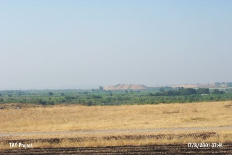 |
|
Type:
|
Mound |
|
Altitude:
|
370 m |
|
Region:
|
Southeastern Anatolia |
|
Province:
|
Gaziantep |
|
District:
|
Karkamis |
|
Village:
|
Barak |
|
Investigation Method:
|
Excavation |
|
Period:
|
|
|
|
|
 |
|
| Location: The site of Karkamis/Carchemish lies southeast of the city of Gaziantep; approximately 30 m south of the town of Nizip; at the Turkish-Syrian border; between Barak and Cerablus (Jerablus). |
| Geography and Environment: The site; which lies on the western bank of the Euphrates River; has an important location because it lies on major trade routes. The site is approximately 900x900 m in size. |
| History: |
| Research and Excavation: The ruins of Carchemish were first noticed in 1699 by H. Maundrell, the representative of a British company in Aleppo. In the 18th century, A. Drummond, the British Consul to Aleppo drew a plan of the city [Peker 2005:38]. It was excavated in 1878-81,1911-14 and 1919-20 by D.H. Hogarth, T.E. Lawrence and L. Woolley, respectively [Sevin 2003b:183]. The excavations were discontinued between 1914 and 1918 due to the war, and many objects discovered during that period disappeared. Recently, the site was visited again by a team led by G. Algaze. After a long break, excavations were launched again in 2011 by N. Marchetti. Excavations are still going on under the directory of N. Marchetti. Karkamis is listed as an officially registered archaeological site by the Ministry of Culture and Tourism. It takes place in the registered archaeological sites list prepared by Ministry of Culture and Tourism. |
| Stratigraphy: The excavations yielded occupations from the Neolithic Age (questionable), Middle/Late Halaf (?), Late Ubaid, Late Chalcolithic, Middle/Late Uruk, Early Bronze Age, late Early Bronze Age, Late Bronze Age, Iron Age, Hellenistic/Early Roman, Late Roman/Early Byzantine Periods. It is believed that the Iron Age settlement covered an area of ca. 1.5 acres [Algaze 1994b:61]. The excavations indicate that the city of Carchemish was a big metropolis as a center of art, particularly during the Late Hittite Period [Darga 1992:221]. |
| Small Finds: Architecture: The settlement bears technical characteristics of the Hittite and Assyrian military architecture. The fortifications were discontinued from place to place in order to utilize from the smallest uneven terrain in the plain for the defense system. The fortifications have seven sections, the even sections were set by superimposed soil. This set delimits the Inner Town to the northwest, stretching till the southeastern tower. The surface of the piled-up set was covered with clay, rising from a depth of 5 m up to 20 m. The 10 m wide ridge of this earthern set is overlaid by a mudbrick wall. The intact plastic and relief sculptures above the stone orthostates of the city gates at Carchemish are associated with the architecture like in the other Late Hittite cities. The Temple of the Storm God uncovered in the section facing the Euphrates and the Hilani structure are well-preserved. Opposite to the wall so called the Herald's Wall is a temple within a sacred area which delimits some sections of the Long Wall of Sculpture. The temple measures 13x11.8 m in dimensions. The Temple of Carchemish was dedicated to the Storm God around 900 BC by the King Katuwas. There are some data indicating that the sacred area on which the temple is located can be dated to an earlier period [Çilingiroglu 1997:72]. In 2011, the excavations and surveys were carried out in six areas (numbered from A to F). Area A extends from the Great Staircase to the beyond the temple of the Storm God at the foot of the acropolis. The temple is in tower-like plan and it has a porch on the front. It was built with orthostat-lined walls. To the north, the cell, remained unexcavated, was exposed. A new excavation area has been opened beyond the gate, in the Inner Town, in order to study the occupational sequence in the area. The remnants belonging to the 7th century BC were exposed in Area E in the Outer Town to the west [Marchetti 2013]. In 2012, the excavations carried out in the Great Staircase were fulfilled. The surrounding area of the Storm God temple in the west of Area A was enlarged towards the south in order to reveal the plan of area in front of the King's Gate, the south temenos wall and the streets beyond it. In several spots, IA II-III levels were encountered. The temple courtyard belonging to IA II was exposed down to its temenos wall. Although the "altar" found by Woolley was encountered again, a floor and a niche built with baked tiles, which were not exposed before, were found in this area. Located to Area B, the monumental structure that is known as "Hilani" (in fact templum in antis) was completely excavated. To the west of Area C, a floor fragment and a few rows of walls belonging to IA III period were unearthed. Several rooms containing findings belonging to IA II and III were exposed in the palace in the east of Area C. These rooms have beeb severely damaged by the structures in the upper levels. The palace was divided into two sections by a wall. The entrance hall is located to the north section. The south section, on the other hand, has more complex arrangement. Two building levels were determined in this section [Marchetti 2014]. The 2014 studies aimed to understand Iron Age town, settlement dynamics and material change through time and space. Although the excavations concentrated on the so-called area Lower Palace, the studies were also carried out in Area C, A, G, L, N and P, and in Yunus necropolis. The studies continued in Area C that encompasses the King's Gate and Katuwa's Palace. The detailed stratigraphical sequence of this area was worked in 2013 and in 2014, the extensive areas, which yielded layers dated to Iron Age, Roman and Islamic Period, were opened. The earliest phase is represented by a large building (it has probably a public function) with mudbrick walls. This building was sealed by the King's Gate and Katuwa's Palace. It seems to have been abandoned based on the lack of sherds dating to later periods. A sequence of cobbled courtyards (L.929 and L.3667), bordered by walls, was exposed in the west of the King's Gate. Several rooms with a complicated stratigraphy from Iron II and III periods were identified inside the Katuwa's Palace. These rooms were damaged due to the later occupation. The palace consists of different sectors and pavilions. The northern unit of the palace was exposed in the previous years. In 2014, the studies concentrated on the southern unit, of which only the northernmost limit was dug. A courtyard paved with square limestone slabs (L.2744) is accessible through doorways in the north (L.3219) and east (L.5344). There is a large rectangular room (L.5085) in the south of the courtyard. The northern side of this room was lined with two limestone orthostats in situ, featuring a procession of gazelle-bearers. The third orthostat was found in a pit, dated to Islamic Period, less than 2 m away. These orthostats (KH.14.O.890, KH.14.O.892 and KH.14.O.889) are very similar to those of the Processional Entry, but they are smaller and of a higher style. The western edge of the palace met the impressive stone paved roadway (L.2949) [Marchetti 2016:363-364; 367-368]. Pottery: An ostrakon bearing an incised nude female figure holding her breats was found in the courtyard of the building in the west of the temple of the Storm God [Marchetti 2013]. Metal: During the studies carried out in the temple of the Storm God, a bronze statuette representing the Storm God was recovered immediately below the floor of the cell. The statuette wearing a kilt with a high cap is 1.3 kg and the cap has a double pair of horns, broken away. The cell of the so-called Hilani Temple in Area B yielded a bronze cylinder seal. The seal belonging to a town official bears Luwian inscription on it. In Area F, a bronze bowl dated to the 7th century BC was discovered among the remains of the House A which was formerly excavated by Woolley, together with a few bronze objects [Marchetti 2013]. Statue/Relief: The reliefs uncovered during the Carchemish excavations are exhibited at the Museum of Anatolian Civilizations in Ankara. The artifacts recovered from the Inner Town are dated to the Iron Age, to 1000-600 BC [Darga 1992:229]. Only the eastern section being excavated, the Inner Town yielded a gate decorated with reliefs, which was called the Water Gate as it faces the Euphrates, and several royal and religious structures accessible through this gate [Sevin 2003b:183]. The Water Gate Reliefs are dated prior to 950 BC based on their stylistic properties and content of the inscriptions; thus, they are in traditional Hittite style [Darga 1992:230]. The orthostats on the Herald's Wall bear Late Hittite (850-800 BC) characteristics with Assyrian influence. The very long part of the wall was adorned with reliefs; 13 orthostats were recovered in situ [Darga 1992:239, 245]. These reliefs have a kind of extensive forms. They depict interrelated compositions involving more than one figure together. The orthostats on the Herald's Wall are associated with some orthostats around the King Gate of the same style. The kings referred here are Suhis and Katuwas as father and son [Darga 1992:247]. With its orthostats including groups of twosome, chariots with horses, gods and armed warriors, the Long Wall of Sculpture and with a depiction of a long cult procession, the Processional Entry are representatives of the Assyrianized Late Hittite style (800-750/700 BC) at Carchemish [Darga 1992:247, 251]. The expressive looks in these reliefs are striking. There is no consensus in dating the relief of the King of Carchemish Katuwas on a basalt orthostad, which was found near the Processional Entry, and whose original place is unknown. E. Akurgal equates Katuwas and Pisiris, who reigned during the second half of the 8th century BC, and suggests this date while J. Hawkins and K. Bittel date it to the 9th century BC. On the other hand, M. Darga suggest the late 9th century/early 8th century BC [Darga 1992:256]. The most striking samples of the Assyrianized Late Hittite Style can be observed at 8 in situ orthostats recovered from the Royal Buttress. The latest dynasts of Carchemish, individuals of the Yariris and Kamanis families, their guards and soldiers were elaborately depicted on the Royal Buttress. The figures on the relief head towards a large inscription. The relief is dated to the late 8th century BC. Similarities with the Neo-Babylonian clothing, which emerged during the last quarter of the 8th century BC contribute to determination of dates [Darga 1992:265-270]. The city had thick double walls defending it, with towers and gates. On the citadel were orthostats, or stone slabs set at the bottom of mudbrick walls, that were carved in an eclectic style peculiar to northern Syria. Elements of the Assyrian art, possibly brought by Hurrians from northern Syria, can also be observed at Carchemish. During the 2011 studies, an almost complete bronze stele was discovered on the southwestern slopes of the acropolis. The top of the stele bears astral symbols (a star, a crescent and a winged disk) and eight lines of Luwian hieroglyphic script. The stele was dedicated at the beginning of the 10th century BC by Suhi I to Uratarhunda, on occasion of a victory against the Assyrian (?) army. In addition to this, dozens of fragments of sculptures and inscriptions were collected on the surface of the Inner Town [Marchetti 2013:354]. Human Remains: In the outer city, a cremation burial was excavated in Area F that is located near the double fortification wall in the west of House E. It is possible this grave was a part of a larger necropolis. Burial goods indicate the 7th century BC (IA III). The grave yielded a bowl placed onto a crater [Marchetti 2014:238]. |
| Remains: |
| Interpretation and Dating: Carchemish is the most powerful of the Late Hittite Kingdoms emerged within the 300 years following the fall of the Hittite Empire. Involving elements originating from the Hittites, it was founded in a strategical location presently called Jerablus on the western bank of the Euphrates over the Turkish-Syrian border, commanding the main ford of the Euphrates River. The name is known since the mid-3rd Millennium BC. It was managed by vassal rulers of the Hittite royal family during the Hittite Imperial Period. Maintaining its significance during the 1st Millennium BC, the state was described as the "Great Hatti" by the Assyrian kings of the 11th century. Ini-Teshup,Talmi-Teshup and his son Kuzi-Teshup were the rulers at the end of the 2nd Millennium BC. According to the Assyrian inscriptions, the city was ruled by Sangara (870-848 BC) during the 9th century BC, and maintained it independence by paying tribute to the Empire. The Hittite hieroglyph inscriptions recovered from Carchemish indicate dominance of two dynasties in the city, the Luhas dynasty during the 10th century BC, followed by the Araras dynasty. The latter was dominant during the 8th century BC. The latest Carchemish King is Pisiris (738-717 BC), who was punished by the Assyrians as he was involved in some intrigues together with the Phrygian King against the Assyrians, and consequently the independence of the city was lost in 717 BC [Sevin 2003b:184-185; Peker 2005:43]. The neighbors of Carchemish was Kummuh to the north, Arpad to the west, and probably Samal or Gurgum to the northwest [Peker 2005:41]. |