|
©The Archaeological Settlements of Turkey - TAY Project
|
|
|
|
|
|
Karkamis |
|
|
For site maps and drawings please click on the picture...  |
For photographs please click on the photo... 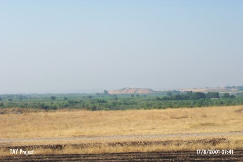 |
|
Type:
|
Mound |
|
Altitude:
|
370 m |
|
Region:
|
Southeastern Anatolia |
|
Province:
|
Gaziantep |
|
District:
|
Karkamis |
|
Village:
|
Barak |
|
Investigation Method:
|
Excavation |
|
Period:
|
Ceramic |
|
|
|
 |
|
| Location: The site of Karkamis/Carchemish lies southeast of the city of Gaziantep; approximately 30 m south of the town of Nizip; at the Turkish-Syrian border; between Barak and Cerablus (Jerablus). |
| Geography and Environment: The site; which lies on the western bank of the Euphrates River; has an important location because it lies on major trade routes. The site is approximately 900x900 m in size. |
| History: |
| Research and Excavation: The site of Karkamis/Carchemish was discovered in 1876 by G. Smith. The first excavations at the site were conducted by the British Ambassador to Aleppo; P. Henderson in 1878-1881. In 1911-12; excavations were led by D.G Hogart; R. Campbell-Thompson and L. Woolley. In 1914 L. Woolley and T.E. Lawrence; in 1920 L. Woolley took over excavations at the site for the British Museum. Recently, the site was visited again by a team led by G. Algaze. After a long break, excavations were launched again in 2011 by N. Marchetti. Excavations are still going on under the directory of N. Marchetti. Karkamis is listed as an officially registered archaeological site by the Ministry of Culture and Tourism. |
| Stratigraphy: The Neo-Hittite/Iron Age Period at the site was built on the Neolithic (?); Chalcolithic and Early Bronze Age settlements on the mound. Virgin soil could not be reached in the excavations conducted. The older periods at the site could be found only on the slopes of the mound. The stratigraphy could never be determined. There is possibly an Aceramic Neolithic Layer beneath the Ceramic Neolithic Layer which lies between meter 18 and 23 on the skirts of the mound. |
| Small Finds: Pottery: The ceramics found at the lowest levels of the mound; which include Dark Burnished Ware; show close affinity with Amuq A and B wares. They have been assigned to the Neolithic Period by Woolley. Chipped Stone: Obsidian and flint sickle blades and points; cores and perforators have been found at the mound. A similar point was found in the Amuq Plain. Ground Stone: Celts; marble and rock-crystal beads were found. |
| Remains: |
| Interpretation and Dating: In ASPRO; Karkamis/Carchemish is reported; according to the limited and contradictory published information; either to be placed into the 3-4 phases (which uncalibrated date to 9;600-8;000 BP) or into the 5-6 phases (8;000-7;000 BP). The chipped stone assemblage strongly suggests that there is a pre-Pottery Neolithic Settlement at the site [Hours et al. 1994:93]. Similarly; because the site yielded Amuq A and B type ware; it can also be placed in the 5/6 phases in ASPRO. It is difficult to conclude whether there really was Ceramic Neolithic or Aceramic Neolithic settlement at the site because the excavations conducted here in the first half of this century did not determine the stratigraphy of the earlier levels at the site. New excavations should be conducted. The Neolithic levels at this site are questionable but the strategic location of Karkamis/Carchemish leads one to conclude that it was probably inhabited in the Neolithic as well. |