|
©The Archaeological Settlements of Turkey - TAY Project
|
|
|
|
|
|
Karkamis |
|
|
For site maps and drawings please click on the picture...  |
For photographs please click on the photo... 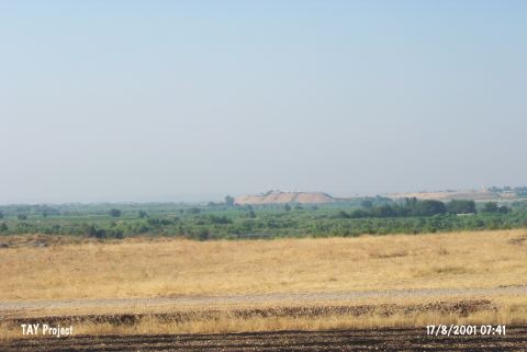 |
|
Type:
|
Mound |
|
Altitude:
|
370 m |
|
Region:
|
Southeastern Anatolia |
|
Province:
|
Gaziantep |
|
District:
|
Karkamis |
|
Village:
|
Barak |
|
Investigation Method:
|
Excavation |
|
Period:
|
Late Middle |
|
|
|
 |
|
| Location: The site of Karkamis/Carchemish lies southeast of the city of Gaziantep; approximately 30 m south of the town of Nizip; at the Turkish-Syrian border; between Barak and Cerablus (Jerablus). |
| Geography and Environment: The site; which lies on the western bank of the Euphrates River; has an important location because it lies on major trade routes. The site is approximately 900x900 m in size. |
| History: |
| Research and Excavation: The site of Karkamis/Carchemish was discovered in 1876 by G. Smith. The first excavations at the site were conducted by the British Ambassador to Aleppo; P. Henderson in 1878-1881. In 1911-12; excavations were led by D.G Hogart; R. Campbell-Thompson and L. Woolley. In 1914 L. Woolley and T.E. Lawrence; in 1920 L. Woolley took over excavations at the site for the British Museum. Recently, the site was visited again by a team led by G. Algaze. After a long break, excavations were launched again in 2011 by N. Marchetti. Excavations are still going on under the directory of N. Marchetti. Karkamis is listed as an officially registered archaeological site by the Ministry of Culture and Tourism. |
| Stratigraphy: Although the existence of a Neolithic settlement on the mound is dubious; it is obvious that the site exposes continuity in settling from the Chalcolithic Age to Iron Age. However; the most striking remains come from the Late Hittite Period settlement; when the site reaches its broadest limits; surrounded by a monumental city wall. The lower levels are recovered only through step-trenches; therefore the stratigraphy is not precise and virgin soil has not been reached. |
| Small Finds: Architecture: The Chalcolithic Age levels were excavated in 1911; 1912; and 1914 by Hogarth; only at the lower slopes of the acropolis; in the deep sounding east of the mound; at a depth of 20 m from the top. The remains displayed no apparent plan. Pottery: The Halaf pottery recovered in the lower levels is reported to be similar to those found in the close site of Yunus Human Remains: Late Chalcolithic Age large jar burials were recovered below the rather recent levels; in the acropolis. These consist of two types: earlier ones without grave goods and the later with beads; small vessels; and copper/bronze weapons. Hogarth claims that the burials were made below the floors. The bevelled rim bowls in some burial jars have led to the thought that these are interrelated with Late Uruk Period. There is not much information about the skeletons. |
| Remains: |
| Interpretation and Dating: The site is one of the most important Chalcolithic Age sites of Southeastern Anatolia with the dubious Middle/Late Halafian finds; Late Ubaid Period and Late Chalcolithic Age levels. |