| ©The Archaeological Settlements of Turkey - TAY Project | ||||||
|
|
||||||
Karaagaçtepe |
||||||
|
|
||||||
| Ages | Maps | Photos | ||||
| Neolithic Chalcolithic EBA |
 |
 |
||||
|
|
||||||
|
Type:
|
Mound | |||||
|
Altitude:
|
10 m | |||||
|
Diameter:
|
m- Direction: | |||||
|
|
||||||
|
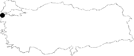
Region:
|
Marmara | |||||
|
Province:
|
Çanakkale | |||||
|
District:
|
Eceabat | |||||
|
Village:
|
Seddülbahir | |||||
|
|
||||||
|
Destruction :
|
Agriculture | |||||
|
|
||||||
|
TAYEx:
|
Visited - 19/6/2000 | |||||
|
|
||||||
|
Registration State:
|
Registered For detailed registration information please refer to Turkish pages. | |||||
 |
||||||
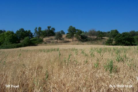
| Location: It lies 3 km northeast of the Seddülbahir Village on the Gelibolu (Gallipoli) Peninsula; southwest of the Eceabat District of the Çanakkale Province. It is coded under H 1/2. |
| Geography and Environment: It is located at the end of the Gallipoli Peninsula. It is also known as tumulus of Protesilaous who fought the Trojans. It lies 1 km far from the Gulf Morto; on the northern bank of the Kirte Stream. It measures 8 m in height and 100-126 m in diameter [Schliemann 1884:draw. at 133]. Terrace walls were seen on the slopes when it was surveyed by H. Schliemann. The settlement is located in a small valley of fertile lands. It is surrounded by fields. |
| Destruction Details: The skirts of the mound have been cut to make fields [TAYEx 19.6.2000]. |