|
©The Archaeological Settlements of Turkey - TAY Project
|
|
|
|
|
|
Karaagaçtepe |
|
|
For site maps and drawings please click on the picture... 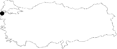 |
For photographs please click on the photo... 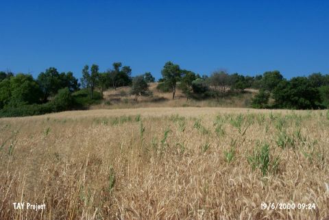 |
|
Type:
|
Mound |
|
Altitude:
|
10 m |
|
Region:
|
Marmara |
|
Province:
|
Çanakkale |
|
District:
|
Eceabat |
|
Village:
|
Seddülbahir |
|
Investigation Method:
|
Excavation |
|
Period:
|
Ceramic |
|
|
|
 |
|
| Location: It lies 3 km northeast of the Seddülbahir Village on the Gelibolu (Gallipoli) Peninsula; southwest of the Eceabat District of the Çanakkale Province. It is coded under H 1/2. |
| Geography and Environment: It is located at the end of the Gallipoli Peninsula. It is also known as tumulus of Protesilaous who fought the Trojans. It lies 1 km far from the Gulf Morto; on the northern bank of the Kirte Stream. It measures 8 m in height and 100-126 m in diameter [Schliemann 1884:draw. at 133]. Terrace walls were seen on the slopes when it was surveyed by H. Schliemann. The settlement is located in a small valley of fertile lands. It is surrounded by fields. |
| History: |
| Research and Excavation: In 1882 H. Schliemann; who believed the mound was a tumulus; opened a trench and excavated to a depth of 2.5 m from the surface. After the First World War; in 1921-23; French Occupying Forces conducted an excavation on the mound under the direction of R. Demangel. In 1982; the site was systematically surveyed by a team led by M. Özdogan during their survey of the Gallipoli Peninsula. It was revisited by O. Özbek in 2008 as part of the survey. It takes place in the registered archaeological sites list prepared by Ministry of Culture and Tourism. |
| Stratigraphy: Although excavated as early as the 1920's; the stratigraphy of the mound was determined. The material cultural deposit at the mound appears to be 11.5 m deep. The upper most meter and a half is a Byzantine layer which overlies a series of four prehistoric layers. Each one of these layers is comprised of many occupational phases. From latest to earliest: Layer 4 and Layer 3 have been dated to Troy II (Early Bronze Age); Layer 2 has been assigned to Troy I (Early Bronze Age) while finds from Layer 1 compare with the Kumtepe Ib finds and have been assigned either to the Chalcolithic or perhaps the Late Neolithic Periods. |
| Small Finds: Pottery: It is thought that some of the ceramics at the very bottom of the 4.5 m thick Chalcolithic Layer 1 may be Early Chalcolithic-Late Neolithic in date [Özdogan 1986d:54]. Neolithic sherds were encountered in the ploughed fields on the skirts of the mound during the survey performed by O. Özbek in 2008 [Özbek 2010:245]. Chipped Stone: Özdogan's survey yielded obsidian and flint micro-blades. These finds may have Neolithic characteristics. Microlithic tools were found in the ploughed fields on mound skirts during the survey performed by O. Özbek in 2008. But the obsidian finds that M. Özdogan mentioned were not found. The rock similar to obsidian that was encountered is actually a black jasper which is a form of cryptocrystalline quartz similar to obsidian [Özbek 2010:245]. |
| Remains: |
| Interpretation and Dating: The micro-blades found in the latest survey conducted at the site strengthen the proposition that there may have been pre-Chalcolithic habitation at the site. The site is in a strategic location facing the Gallipoli Strait. |