| ©The Archaeological Settlements of Turkey - TAY Project | ||||||
|
|
||||||
Harran |
||||||
|
|
||||||
| Ages | Maps | Photos | ||||
| Chalcolithic EBA IA |
 |
 |
||||
|
|
||||||
|
Type:
|
Mound | |||||
|
Altitude:
|
400 m | |||||
|
Diameter:
|
m- Direction: | |||||
|
|
||||||
|
Region:
|
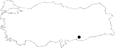
Southeastern Anatolia | |||||
|
Province:
|
Sanliurfa | |||||
|
District:
|
Harran | |||||
|
Village:
|
Merkez | |||||
|
|
||||||
|
Destruction :
|
Contemporary Settlements | |||||
|
|
||||||
|
TAYEx:
|
Visited - 1/9/2001 | |||||
|
|
||||||
|
Registration State:
|
Registered For detailed registration information please refer to Turkish pages. | |||||
 |
||||||
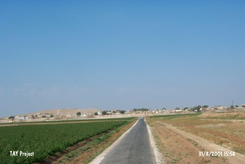
| Location: It lies almost in the middle of Harran town; 44 km southeast of the Sanliurfa Province. It can be easily accessed from the Sanliurfa-Harran motorway. |
| Geography and Environment: It is partly obscured by the modern town. It is one of the hundreds of settlements located on the lowland of Harran with a size of 30x50 km; on the upper part of the Balih/Belih Valley. 250 mounds were identified as a result of surveys conducted by V. Sevin and particularly by N. Yardimci in this plain [Özfirat 1994: map. 1-2]. It is situated at the joint of the caravan road running from Mesopotamia to Central Anatolia through the Samsat-Malatya motorway; and to the west; the Mediterranean region through Karkamis. Therefore; it is a cult center of Kura during the third millennium BC and of Sin (god of moon) during the second millennium BC. The inscriptions expose that it developed and became a center for cultural activities in the later periods. It is surrounded by fertile arable fields; but it is poor in water resources. The Cullap Suyu originating from Urfa passes by Harran and joins the Euphrates through the Balih Stream. This stream is usually dry in summer time. |
| Destruction Details: The mound is being destructed by the contemporary settlement [TAYEx 1.9.2001]. |