|
©The Archaeological Settlements of Turkey - TAY Project
|
|
|
|
|
|
Harran |
|
|
For site maps and drawings please click on the picture...  |
For photographs please click on the photo... 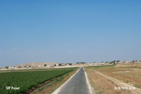 |
|
Type:
|
Mound |
|
Altitude:
|
400 m |
|
Region:
|
Southeastern Anatolia |
|
Province:
|
Sanliurfa |
|
District:
|
Harran |
|
Village:
|
Merkez |
|
Investigation Method:
|
Excavation |
|
Period:
|
New Assyrian Empire Period |
|
|
|
 |
|
| Location: It lies almost in the middle of Harran town; 44 km southeast of the Sanliurfa Province. It can be easily accessed from the Sanliurfa-Harran motorway. |
| Geography and Environment: It is partly obscured by the modern town. It is one of the hundreds of settlements located on the lowland of Harran with a size of 30x50 km; on the upper part of the Balih/Belih Valley. 250 mounds were identified as a result of surveys conducted by V. Sevin and particularly by N. Yardimci in this plain [Özfirat 1994: map. 1-2]. It is situated at the joint of the caravan road running from Mesopotamia to Central Anatolia through the Samsat-Malatya motorway; and to the west; the Mediterranean region through Karkamis. Therefore; it is a cult center of Kura during the third millennium BC and of Sin (god of moon) during the second millennium BC. The inscriptions expose that it developed and became a center for cultural activities in the later periods. It is surrounded by fertile arable fields; but it is poor in water resources. The Cullap Suyu originating from Urfa passes by Harran and joins the Euphrates through the Balih Stream. This stream is usually dry in summer time. |
| History: |
| Research and Excavation: S.Loyd and W. Brice conducted a survey at Harran in 1950. Between the years 1959 and 1983, D.S. Rice launched an excavation project that was followed by a team led by N. Yardimci. In 1983 N. Yardimci and his team initiated surveys, topographical and sounding activities [Yardimci 1985:79]. The excavations initiated in 1984 continiued with the same team until 2011 and mainly focused on the Islamic Period of the city. Since 2014, M. Önal has been leading the excavations at Harran. The site is in the registered archaeological sites list prepared by Ministry of Culture and Tourism. |
| Stratigraphy: It is known that the mound had been uninterruptedly inhabited from 5000 BC to the 13rd century AD [Yardimci 2001:563]. |
| Small Finds: Architectural Structure: To the east of Harran rises a well-preserved citadel. Except the northern section, it is almost extant and well-preserved. It has a rectangular plan, with towers on corners. No precise information is available about its construction date. It is believed that it was also occupied during the Hittite, Assyrian and Neo Babylonian Periods (a significant site during the reign of Assurnasirpal and Assurbanipal in the Assyrian Period and during the reign of Nabonidus in the Neo-Baylonian Period). The Sin's Temple was probably located here [Yardimci 1985:79-80]. In 2011, tile fragments with cuneiform inscription (votive tablet) belonging to Babylonian King Nabonidus period were found in the red colored, ashy, mubrick rubble fill. This fill sloping towards the northeast is located in the center of Trench 35 EE with a dimension of 9x7 m and it covers the western half and center of Trench 36 EE by extending towards the north of the area. A yellow fill with mubrick that measures about 3.50x1.40 cm can be seen on the east of Trench 35 EE. There is a green colored fill with mudbrick on the east of trench 36 EE. It measures the same with the yellow one. On the east section of Trench 36 DD, mudbrick remains which probably belong to a structure were found. Adjacent tile rows extending into the profile were encountered near the south profile. These tile remains extending in the east-west direction could be traced along 6 m. The narrow tiles on the northern edge of the pavement form a line reaching east to west. The fact that this tile row is too narrow for a wall and a different mubrick like line was found outside of this row, it couldn't be determined that which one of the wall fills surrounds this area. However, it was seen that large square tiles continued 4 m towards the east. During the leveling studies carried out in 36 DD, L shaped mudbrick wall (?), the long part of which extends towards the southeast of the trench and the short part reaches into the south profile, was found on the south section of the fireplace with a dimension of 45x55 cm. There is another mudbrick wall (?) that is parallel to the L shaped one. This wall-like remain begins from the west profile and extends towards the southeast. It is located at the same line with Trench 35 DD and 36 DD situated about 2 m south [Yardimci 2013:36]. Pottery: Limited number of sherds dating to the Assyrian Empire were recovered from the surface and underlying levels [Russell 1987:57]. The Neo Babylonian level yielded abundant number of sherds belonging to the 1st Millennium BC [Yardimci 2005:361]. The trench 35EE yielded intense number of Islamic Period sherds as well as sherds dating to the 1st Millennium BC [Yardimci 2007:718]. Figurines: The dog figurines recovered are probably dated to the Period of Nabonidus [Mellink 1987:7]. The deepening activities which was enlarged as a continuation of the trench (B) and corresponding to the plan square 35EE yielded fragment of a beige colored rhyton having depiction of a swine's head in the upper deposit. Absence of rhyton during the Islamic Period, and again prohibition of any swine depictions during the Islamic Period and its similarity to the Iron Age material resulted in dating of this artefact to the 1st Millennium BC for now [Yardimci 2007:718]. Epigraphic Material: The cuneiform inscribed tablet, cuneiform inscribed terracotta brick and the votive inscription with stamped cuneiform previously found are dated to the 6th century BC. These votive inscriptions referring to the E-hul-hu-sin Temple dedicated to the Moon God by the King Nabonidus during the Neo Babylonian Period, and most importantly showing the location of this temple are very significant. Owing to these votive inscriptions with stamped cuneiform terracotta brick, it was learnt actually from the King Nabonidus himself that the Temple of Sin was built in Harran, and also fragments of the original architectural bricks were found. Those 52 pieces of great and small cuneiform inscribed terracotta bricks were used for the construction of the Temple of Sin [Yardimci 1991a:364-365]. The trench 35DD which was previously excavated to a great extent had also yielded 52 pieces of votive inscriptions with stamped cuneiform. The new excavations revealed remaining fragments of the votive inscriptions with cuneiform in the other sections of the brick-paved building from the Islamic Period where the cuneiform inscriptions were also uncovered [Yardimci 1992a:424]. The trench B yielded a votive inscription of the Temple of Sin dating to the reign of the King Nabonidus (556-536 BC) at the building level of the 1st Millennium BC [Yardimci 2005:361]. The content of the two inscriptions uncovered at the Great Mosque in Harran is as follows: The first one reads "....-ma a-si?....(2)......ti-iz-....kar....(3).....li....." while the second one includes "...a-na -ku E HUL.HUL. bit (d) sin (3).....same u ersheti (ti)beli-la lu -u- rib-bu-us" [Saggs 1969:167]. Fragments of two broken and cuneiform votive incriptions of the Temple of Sin were found at an approximate depth of 1.35 m in front of the southern wall of the trench 35EE, which are dated to the 6th century BC, to the Neo Babylonian Period/Nabonidus Period. And, again fragment of the same votive inscription was recovered from a depth of 1.5 m below the surface where the Islamic Period millstone was found to the southeast of the trench. And, a thin white floor was observed extending from west to east at a depth of 1.9 m on the upper level of the northern wall of the trench. The wall between the trench D, which was opened as an extension of the trench B in 2005 and the trench B was removed, and it was completely referred as trench B. In this trench, the floor level of the garbage pit, which was exposed in 2004 and dated to the 1st Millennium BC was reached. Both the 1st Millennium ceramics and the inscribed fragments belonging to the Temple of Sin indicate that this layer was a 1st Millennium building level [Yardimci 2007:718-719]. |
| Remains: |
| Interpretation and Dating: It was called "Harran-u", which means journey and caravan in Sumerian and Akkadian as it was located at the intersection of the roads leading to the Mediterranean coast, to the west and northwest from Mesopotamia. Also situated on a trade route linking Assyria with Anatolia, Harran was the haunt of the Assyrian merchants, who were in close trading activities with Anatolia. The city was referred as Uru-ki-kaskal-al Harran at the time of the Kingdom of Babylon [Yardimci 2001:563]. During the 2nd Millennium BC, Harran was the second in importance following the city of Assur. It became a capital for a short period of time during the Late Assyrian Period. And, later on it was dominated by the Parthians under the name of Carrhae until 54 BC [Yardimci 2001:563]. Harran was at a significant intersection of roads known as I-na Ha-ar-an or I-Ha-ra-na/an during the Assyrian Period [Yardimci 1990:719]. The Assyrians mention about tributes and taxes they received from Harran during the reign of Adad-Nirari in the 10th century BC, which indicate that Harran was not subjected to Assyria between the 10th century BC and the first quarter of the 9th century BC. As a matter of fact, it is mentioned in the documents dated to the 7th century BC that mostly Aramian people lived in Harran during that period. However, Harran and its neighbourhood certainly became a Province of Assyria during the mid-9th century BC. Furthermore, it is quite obvious that it became a provincial center from the first half of the 8th century BC [Özfirat 1994b:43-47]. Following the reign of Sargon II, the name of Harran can only be seen once again in the Assyrian records during the reign of Esarhaddon (680-669 BC). The restoration projects of this Assyrian King included the Temple of Sin at Harran. Based on the written documents, it is learnt that the Temple of Sin was rebuilt by Assurbanipal towards the end of the 7th century BC. The Assyrians who escaped from Nineveh following the defeat of the town in 612 BC by the Medes and Scythians declared Harran as the new capital, which lasted very short when the same enemies who conquered Nineveh attacked Harran in 610 BC, and demolished the city [Özfirat 1994b:51-57]. It was followed by the dominion of the Neo-Babylonian Period (610-539 BC) in Harran. The city became a part of the Persian Empire with the fall of the Babylonian Kingdom to Kyros. And, it was attached to the Babylonian Satrapy during the reign of Darius I (early 5th century) [Özfirat 1994b:57, 62]. |