|
©The Archaeological Settlements of Turkey - TAY Project
|
|
|
|
|
|
Harran |
|
|
For site maps and drawings please click on the picture...  |
For photographs please click on the photo... 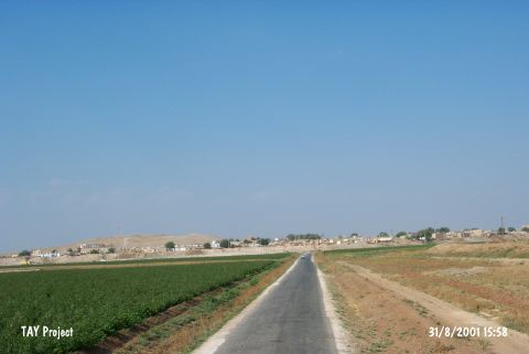 |
|
Type:
|
Mound |
|
Altitude:
|
400 m |
|
Region:
|
Southeastern Anatolia |
|
Province:
|
Sanliurfa |
|
District:
|
Harran |
|
Village:
|
Merkez |
|
Investigation Method:
|
Excavation |
|
Period:
|
Early Middle Late |
|
|
|
 |
|
| The site lies 44 km southeast of Sanliurfa. The first surveys; covering an area from Cilicia to Van Lake; were conducted by Dönmez and Brice in 1947. S.Loyd and W. Brice conducted a survey at Harran in 1950. Between the years 1959 and 1983 D.S. Rice launched an excavation project that was followed by a team led by N. Yardimci until 2011. Since 2014, M. Önal has been leading the excavations at Harran. According to the stratigraphy; the lowest level was the Pre-Dynasty Period; which include Halaf; Ubaid and Jemdet Nasr Phases. In the level above come the remains from the 3rd Millennium: the Early Dynasties II and III Periods. Late 3rd Millennium BC; Akkad and Ur III Periods were found at the highest level. The similar type of sherds; dating to the prehistoric times; were found at Sultantepe and Asagi Yarimca Mounds. Halaf finds were also uncovered during the last season excavations conducted by N. Yardimci [Yardimci:2005:362]. The Pre-Halaf finds that were unearthed during the 2006 researches at Tell Idris unveiled the probability, that the first inhabitants of Harran first lived at Tell Idris, which is very close to Harran, then lived together with Harran for a certain period of time, and finally the life that stopped there, continued at Harran only. The fact that the settlement date for Tell Idris goes back to the Late Neolithic Age based on the finds that were unearthed, also changed the known foundation date of Harran [Yardimci 2008.364]. It takes place in the registered archaeological sites list prepared by Ministry of Culture and Tourism. |
| Location: It lies almost in the middle of Harran town; 44 km southeast of the Sanliurfa Province. It can be easily accessed from the Sanliurfa-Harran motorway. |
| Geography and Environment: It is partly obscured by the modern town. It is one of the hundreds of settlements located on the lowland of Harran with a size of 30x50 km; on the upper part of the Balih/Belih Valley. 250 mounds were identified as a result of surveys conducted by V. Sevin and particularly by N. Yardimci in this plain [Özfirat 1994: map. 1-2]. It is situated at the joint of the caravan road running from Mesopotamia to Central Anatolia through the Samsat-Malatya motorway; and to the west; the Mediterranean region through Karkamis. Therefore; it is a cult center of Kura during the third millennium BC and of Sin (god of moon) during the second millennium BC. The inscriptions expose that it developed and became a center for cultural activities in the later periods. It is surrounded by fertile arable fields; but it is poor in water resources. The Cullap Suyu originating from Urfa passes by Harran and joins the Euphrates through the Balih Stream. This stream is usually dry in summer time. |
| History: |
| Research and Excavation: |
| Stratigraphy: |
| Small Finds: |
| Remains: |
| Interpretation and Dating: |