| ©The Archaeological Settlements of Turkey - TAY Project | ||||||
|
|
||||||
Girnator |
||||||
|
|
||||||
| Ages | Maps | Photos | ||||
| Chalcolithic EBA |
 |
 |
||||
|
|
||||||
|
Type:
|
Mound | |||||
|
Altitude:
|
700 m | |||||
|
Diameter:
|
m- Direction: | |||||
|
|
||||||
|
Region:
|
Southeastern Anatolia | |||||
|
Province:
|
Batman | |||||
|
District:
|
Besiri | |||||
|
Village:
|
Binatli | |||||
|
|
||||||
|
Destruction :
|
Illicit Digging - Agriculture | |||||
|
|
||||||
|
TAYEx:
|
Visited - 14/9/2001 | |||||
|
|
||||||
|
Registration State:
|
For detailed registration information please refer to Turkish pages. | |||||
 |
||||||
| Location: |
| Geography and Environment: |
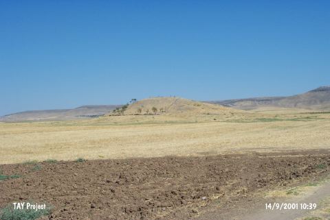
| Destruction Details: The mound of Girnator is destructed by agricultural activities and illicit diggings. There are stones; probably belong to the mound; lined as field border on the surface of the mound. On south skirt of the mound there are three pits dug illicitly in dimension of 2x1 m [TAYEx 14.9.2001]. |