| ©The Archaeological Settlements of Turkey - TAY Project | ||||||
|
|
||||||
Domuz Tepe |
||||||
|
|
||||||
| Ages | Maps | Photos | ||||
| Neolithic Chalcolithic EBA IA |
 |
 |
||||
|
|
||||||
|
Type:
|
Mound | |||||
|
Altitude:
|
50 m | |||||
|
Diameter:
|
m- Direction: | |||||
|
|
||||||
|
Region:
|
Mediterranean | |||||
|
Province:
|
Adana | |||||
|
District:
|
Karatas | |||||
|
Village:
|
Develiören | |||||
|
|
||||||
|
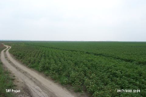
Destruction :
|
Agriculture - Attention | |||||
|
|
||||||
|
TAYEx:
|
Visited - 29/7/2001 | |||||
|
|
||||||
|
Registration State:
|
For detailed registration information please refer to Turkish pages. | |||||
 |
||||||
| Location: |
| Geography and Environment: |
| Destruction Details: After the watering channels opened in 1961-62 the plain was leveled in 1965 by Directorate of Rural Affairs. The mound has been totally leveled today and it can only be recognized by slight height in the middle of a cotton field [TAYEx 29.7.2001]. |