| ©The Archaeological Settlements of Turkey - TAY Project | ||||||
|
|
||||||
Çukurköprü |
||||||
|
|
||||||
| Ages | Maps | Photos | ||||
| Neolithic Chalcolithic |
 |
 |
||||
|
|
||||||
|
Type:
|
Mound | |||||
|
Altitude:
|
80 m | |||||
|
Diameter:
|
m- Direction: | |||||
|
|
||||||
|
Region:
|
Mediterranean | |||||
|
Province:
|
Osmaniye | |||||
|
District:
|
Kadirli | |||||
|
Village:
|
Çukurköprü | |||||
|
|
||||||
|
Destruction :
|
Contemporary Settlements | |||||
|
|
||||||
|
TAYEx:
|
Visited - 30/7/2001 | |||||
|
|
||||||
|
Registration State:
|
For detailed registration information please refer to Turkish pages. | |||||
 |
||||||
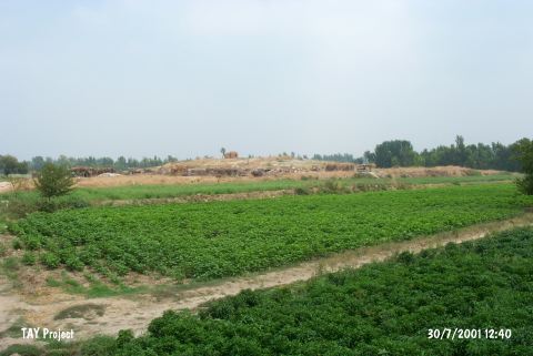
| Location: lies nearby Anavarza junction; south of Kozan-Kadirli motorway and Çukurköprü Village; west of Kadirli District; northeast of Adana Province. |
| Geography and Environment: Approximately 30-40 m of this low lying; 3-4 m high mound has been destroyed by highway construction. There are no water sources or modern towns near the site. There must have been a nearby water source when the mound was inhabited. |
| Destruction Details: The mound has been severely damaged because of being used as a seasonal camp area by nomad people [TAYEx 30.7.2001]. |