| ©The Archaeological Settlements of Turkey - TAY Project | ||||||
|
|
||||||
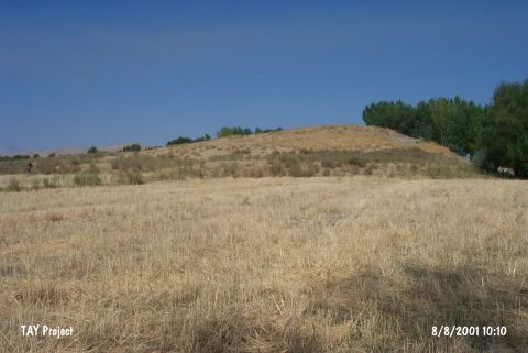
Çebikçil Höyük |
||||||
|
|
||||||
| Ages | Maps | Photos | ||||
| Chalcolithic EBA |
 |
 |
||||
|
|
||||||
|
Type:
|
Mound | |||||
|
Altitude:
|
1200 m | |||||
|
Diameter:
|
m- Direction: | |||||
|
|
||||||
|
Region:
|
Eastern Anatolia | |||||
|
Province:
|
Kahramanmaras | |||||
|
District:
|
Afsin | |||||
|
Village:
|
Karagöz | |||||
|
|
||||||
|
Destruction :
|
Illicit Digging - Highways, roads, bridges etc. | |||||
|
|
||||||
|
TAYEx:
|
Visited - 8/8/2001 | |||||
|
|
||||||
|
Registration State:
|
For detailed registration information please refer to Turkish pages. | |||||
 |
||||||
| Location: |
| Geography and Environment: |
| Destruction Details: The mound has been damaged due to illicit diggings. Its north-northwest skirt has been cut by a road [TAYEx 8.8.2001]. |