| ©The Archaeological Settlements of Turkey - TAY Project | ||||||
|
|
||||||
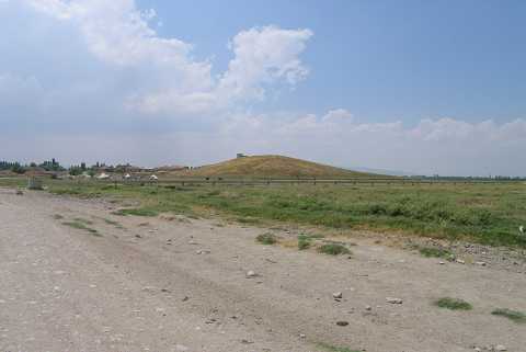
Bozhöyük 2 |
||||||
|
|
||||||
| Ages | Maps | Photos | ||||
| Chalcolithic EBA |
 |
 |
||||
|
|
||||||
|
Type:
|
Mound | |||||
|
Altitude:
|
895 m | |||||
|
Diameter:
|
m- Direction: | |||||
|
|
||||||
|
Region:
|
Aegean | |||||
|
Province:
|
Afyonkarahisar | |||||
|
District:
|
Dinar | |||||
|
Village:
|
Yesilhöyük | |||||
|
|
||||||
|
Destruction :
|
Contemporary Settlements | |||||
|
|
||||||
|
TAYEx:
|
Visited - 15/7/2004 | |||||
|
|
||||||
|
Registration State:
|
For detailed registration information please refer to Turkish pages. | |||||
 |
||||||
| Location: |
| Geography and Environment: |
| Destruction Details: The mound was surrounded by a wall and is currently being used as the cemetery area. On its surface are a water reservoir and a water channel [TAYEx 15.7.2004]. |