|
©The Archaeological Settlements of Turkey - TAY Project
|
|
|
|
|
|
Bozhöyük 2 |
|
|
For site maps and drawings please click on the picture...  |
For photographs please click on the photo... 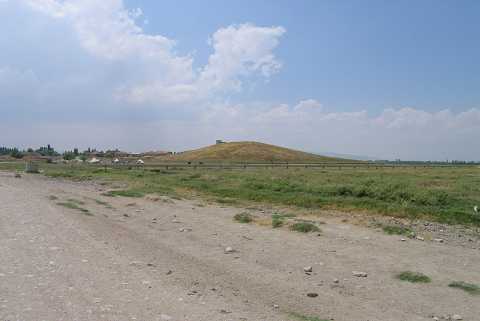 |
|
Type:
|
Mound |
|
Altitude:
|
895 m |
|
Region:
|
Aegean |
|
Province:
|
Afyonkarahisar |
|
District:
|
Dinar |
|
Village:
|
Yesilhöyük |
|
Investigation Method:
|
Survey |
|
Period:
|
Late |
|
|
|
 |
|
| The mound lies in the old location of the village of Yesilhöyük (Bozhöyük); 1.3 km north-northeast of the new village; northwest of Burdur; 21 km northwest of Dinar; south of Gökgöl. According to J. Mellaart; the mound is among the Chalcolithic Age settlements. However; no information is given about the site. It was visited during the survey conducted by Ö. Koçak in 2013 [Koçak 2015:365]. |
| Location: |
| Geography and Environment: |
| History: |
| Research and Excavation: |
| Stratigraphy: |
| Small Finds: |
| Remains: |
| Interpretation and Dating: |