|
©The Archaeological Settlements of Turkey - TAY Project
|
|
|
|
|
|
Bozhöyük 2 |
|
|
For site maps and drawings please click on the picture...  |
For photographs please click on the photo... 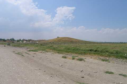 |
|
Type:
|
Mound |
|
Altitude:
|
895 m |
|
Region:
|
Aegean |
|
Province:
|
Afyonkarahisar |
|
District:
|
Dinar |
|
Village:
|
Yesilhöyük |
|
Investigation Method:
|
Survey |
|
Period:
|
EBA II |
|
|
|
 |
|
| It lies about 83 km soutwest of Afyonkarahisar Province as the crow flies. It is situated 10 km northwest of Dinar; close to the border of Usak Province. It was discovered during a survey conducted by J. Mellaart in this region. It was defined as an EBA II settlement in accordance with the sherds collected from the surface. The wares recovered are included in the Kusura-Isparta group. Since it was called Bozhöyük II by J. Mellaart in his first publication; it is cited the same here. The other mound of Bozhöyük lies north of the province. It was visited during the survey conducted by Ö. Koçak in 2013. It is also called Yesilhöyük. Koçak stated that the mound is located 300 m northwest of the village. It measures 180x90 m in dimension and 14 m in height. There are EBA and Roman finds on the mound [Koçak 2015:365-366]. |
| Location: |
| Geography and Environment: |
| History: |
| Research and Excavation: |
| Stratigraphy: |
| Small Finds: |
| Remains: |
| Interpretation and Dating: |