| ©The Archaeological Settlements of Turkey - TAY Project | ||||||
|
|
||||||
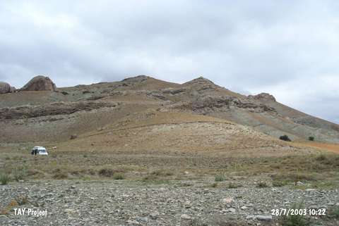
Boran Tepesi |
||||||
|
|
||||||
| Ages | Maps | Photos | ||||
| EBA IA |
 |
 |
||||
|
|
||||||
|
Type:
|
Upland Settlement | |||||
|
Altitude:
|
1410 m | |||||
|
Diameter:
|
m- Direction: | |||||
|
|
||||||
|
Region:
|
Central Anatolia | |||||
|
Province:
|
Sivas | |||||
|
District:
|
Ulas | |||||
|
Village:
|
Baharözü | |||||
|
|
||||||
|
Destruction :
|
Highways, roads, bridges etc. | |||||
|
|
||||||
|
TAYEx:
|
Visited - 28/7/2003 | |||||
|
|
||||||
|
Registration State:
|
For detailed registration information please refer to Turkish pages. | |||||
 |
||||||
| Location: |
| Geography and Environment: |
| Destruction Details: The slopes of the mound have been cut by a road that surrounds the hill; and skirts have been damaged due to agricultural activities [TAYEx 28.7.2003]. |