|
©The Archaeological Settlements of Turkey - TAY Project
|
|
|
|
|
|
Boran Tepesi |
|
|
For site maps and drawings please click on the picture...  |
For photographs please click on the photo... 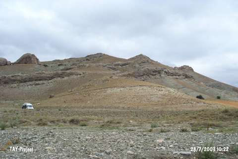 |
|
Type:
|
Upland Settlement |
|
Altitude:
|
1410 m |
|
Region:
|
Central Anatolia |
|
Province:
|
Sivas |
|
District:
|
Ulas |
|
Village:
|
Baharözü |
|
Investigation Method:
|
Survey |
|
Period:
|
Early Iron Age Middle Iron Age Late Iron Age |
|
|
|
 |
|
| It is located on the slopes of a rocky hill on the northern section of the Irmak Stream at Yaglak Mevkii, 5 km west of the Baharözü Village, southwest of Sivas. It was discovered in 1997 during the Survey in the Province of Sivas conducted under the direction of A.T. Ökse. Both the hilltop and the slopes yielded sherds dating to the Chalcolithic Age, Early Bronze Age, Iron Age and Roman Period. |
| Location: |
| Geography and Environment: |
| History: |
| Research and Excavation: |
| Stratigraphy: |
| Small Finds: |
| Remains: |
| Interpretation and Dating: |