| ©The Archaeological Settlements of Turkey - TAY Project | ||||||
|
|
||||||
Kabayar Höyük |
||||||
|
|
||||||
| Ages | Maps | Photos | ||||
| EBA IA |
 |
 |
||||
|
|
||||||
|
Type:
|
Mound | |||||
|
Altitude:
|
330 m | |||||
|
Diameter:
|
m- Direction: | |||||
|
|
||||||
|
Region:
|
Black Sea | |||||
|
Province:
|
Amasya | |||||
|
District:
|
Tasova | |||||
|
Village:
|
Uluköy | |||||
|
|
||||||
|
Destruction :
|
Natural causes - Agriculture - Highways, roads, bridges etc. - Attention | |||||
|
|
||||||
|
TAYEx:
|
Visited - 26/8/2003 | |||||
|
|
||||||
|
Registration State:
|
For detailed registration information please refer to Turkish pages. | |||||
 |
||||||
| Location: |
| Geography and Environment: |
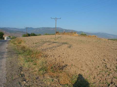
| Destruction Details: The settlement has been damaged by the road to the north and agricultural activities. Its south-southeastern section is being eroded by Yesilirmak river. Electricity poles were located on the mound [TAYEx 26.8.2003]. |