| ©The Archaeological Settlements of Turkey - TAY Project | ||||||
|
|
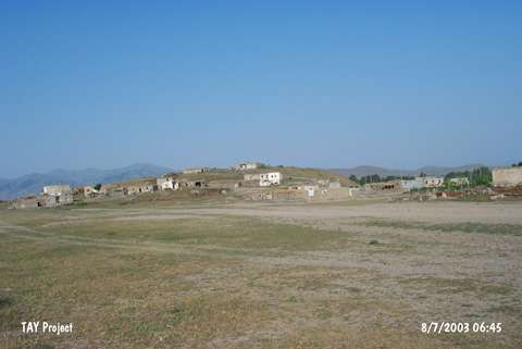
||||||
Gümüspinar |
||||||
|
|
||||||
| Ages | Maps | Photos | ||||
| EBA IA |
 |
 |
||||
|
|
||||||
|
Type:
|
Mound | |||||
|
Altitude:
|
1710 m | |||||
|
Diameter:
|
204 m- Direction: SW-NE | |||||
|
|
||||||
|
Region:
|
Eastern Anatolia | |||||
|
Province:
|
Mus | |||||
|
District:
|
Bulanik | |||||
|
Village:
|
Gümüspinar | |||||
|
|
||||||
|
Destruction :
|
Illicit Digging - Contemporary Settlements - Attention | |||||
|
|
||||||
|
TAYEx:
|
Visited - 8/7/2003 | |||||
|
|
||||||
|
Registration State:
|
For detailed registration information please refer to Turkish pages. | |||||
 |
||||||
| Location: |
| Geography and Environment: |
| Destruction Details: The houses of Gümüspinar Village were built over the mound. Traces of illicit diggings were observed on the top and north of the settlement [TAYEx 8.7.2003]. During the survey initiated in 2009 by Biber-Çavusoglu and planned to last five years it is observed that a water reservoir has partly destructed the architectures on the upper North of the mound and village houses are built in South slopes of the mound [Biber-Çavusoglu 2011:203]. |