|
©The Archaeological Settlements of Turkey - TAY Project
|
|
|
|
|
|
Gümüspinar |
|
|
For site maps and drawings please click on the picture...  |
For photographs please click on the photo... 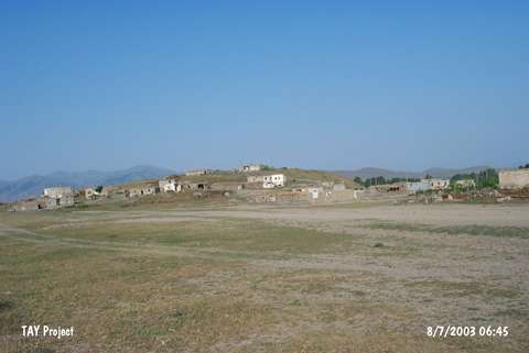 |
|
Type:
|
Mound |
|
Altitude:
|
1710 m |
|
Region:
|
Eastern Anatolia |
|
Province:
|
Mus |
|
District:
|
Bulanik |
|
Village:
|
Gümüspinar |
|
Investigation Method:
|
Survey |
|
Period:
|
|
|
|
|
 |
|
| The site is located immediately southwest the village of Gümüspinar (Pulur/Pülür); 12 km from the district of Bulanik; northeast of Mus Province. It is included in the EBA settlements of Eastern Anatolia by C.A. Burney and reported to be measuring 15 m in height and 150x100 m in diameter. However; during the researches conducted by Özfirat in 1998; its measurements were determined as 30 m in height and 300x250 m in diameter. The geographical features of the area probably caused these two different results. Today; the mound is partially covered by the modern village and there is a survey point on top hill. Rothman; who also conducted a survey in the region; doesn't refer to this mound that was named as Pulur by Burney. The site is re-studied by Biber-Çavusoglu during the survey initiated in 2009 and planned to last five years. The mound is measured as 250 m wide in North-South, and 185 m wide in East-West. The height of the site is 20 m in the North and 10 m in the South. The mound has a flat-conical shape and is flatter in the South and East and steep in the North and West. Square and rectangular planned structures exist in the upper North of the mound. The remains of foundations are made of full-masonry and half-masonry stones that are 70 by 80 cm and 50 by 70 cm in size. Scattered large and no-masonry large stones exist on the other parts of the mound. Pieces of ceramics dating to Early and Middle Iron Age are encountered on the surface of the mound [Biber-Çavusoglu 2011:203]. |
| Location: |
| Geography and Environment: |
| History: |
| Research and Excavation: |
| Stratigraphy: |
| Small Finds: |
| Remains: |
| Interpretation and Dating: |