| ©The Archaeological Settlements of Turkey - TAY Project | ||||||
|
|
||||||
Zeytinli |
||||||
|
|
||||||
| Ages | Maps | Photos | ||||
| EBA IA |
 |
 |
||||
|
|
||||||
|
Type:
|
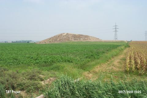
Mound | |||||
|
Altitude:
|
70 m | |||||
|
Diameter:
|
m- Direction: | |||||
|
|
||||||
|
Region:
|
Mediterranean | |||||
|
Province:
|
Adana | |||||
|
District:
|
Seyhan | |||||
|
Village:
|
Zeytinli | |||||
|
|
||||||
|
Destruction :
|
Illicit Digging - Agriculture - Attention | |||||
|
|
||||||
|
TAYEx:
|
Visited - 28/7/2001 | |||||
|
|
||||||
|
Registration State:
|
For detailed registration information please refer to Turkish pages. | |||||
 |
||||||
| Location: |
| Geography and Environment: |
| Destruction Details: The mound is being damaged due to agricultural activities and illicit diggings. Top hill and the eastern slope are being cultivated. Soil removed from its southern skirt and both south and west skirts are leveled. There is a pit on eastern slope [TAYEx 28.7.2001]. |