|
©The Archaeological Settlements of Turkey - TAY Project
|
|
|
|
|
|
Zeytinli |
|
|
For site maps and drawings please click on the picture...  |
For photographs please click on the photo... 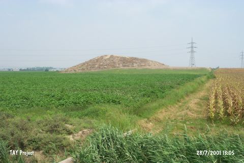 |
|
Type:
|
Mound |
|
Altitude:
|
70 m |
|
Region:
|
Mediterranean |
|
Province:
|
Adana |
|
District:
|
Seyhan |
|
Village:
|
Zeytinli |
|
Investigation Method:
|
Excavation |
|
Period:
|
|
|
|
|
 |
|
| It is located next to the Zeytinli Train Station on the Tarsus-Adana railway, 17 km west from the provincial center of Adana. It is one of the large mounds with terraces on its slopes, and a flat hilltop. It is 20 m high. Sherds collected from the surface during the Cilicia Survey conducted in 1951 were dated from the EBA until the Hellenistic Period [Seton-Williams 1954:131-174]. |
| Location: |
| Geography and Environment: |
| History: |
| Research and Excavation: |
| Stratigraphy: |
| Small Finds: |
| Remains: |
| Interpretation and Dating: |