|
©The Archaeological Settlements of Turkey - TAY Project
|
|
|
|
|
|
Zeytinli |
|
|
For site maps and drawings please click on the picture...  |
For photographs please click on the photo... 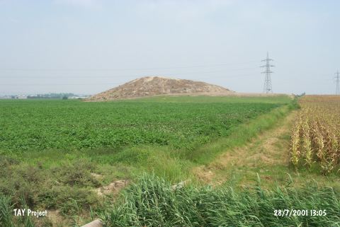 |
|
Type:
|
Mound |
|
Altitude:
|
70 m |
|
Region:
|
Mediterranean |
|
Province:
|
Adana |
|
District:
|
Seyhan |
|
Village:
|
Zeytinli |
|
Investigation Method:
|
Excavation |
|
Period:
|
EBA III |
|
|
|
 |
|
| It lies next to the Zeytinli Station on the Tarsus-Adana railway; 17 km west of Adana Province. It is one of the highest mounds in the region. The top hill is flat and slopes are terraced. It measures 20 m in height. It was excavated as a part of the Cilicia Survey of the Bryn Mawr College. It was a sounding rather than an excavation. It is reported that it used to locate on an old trading route. The excavation materials are preserved at the Museum of Adana. During the Cilicia Survey conducted in 1951; sherds dating from the EBA to the Hellenistic Period were collected from the surface. Also; samples of the metallic ware were recovered. |
| Location: |
| Geography and Environment: |
| History: |
| Research and Excavation: |
| Stratigraphy: |
| Small Finds: |
| Remains: |
| Interpretation and Dating: |