| ©The Archaeological Settlements of Turkey - TAY Project | ||||||
|
|
||||||
Ugurlu / Zeytinli |
||||||
|
|
||||||
| Ages | Maps | Photos | ||||
| Neolithic Chalcolithic EBA 14C |
 |
 |
||||
|
|
||||||
|
Type:
|
Mound | |||||
|
Altitude:
|
0 m | |||||
|
Diameter:
|
m- Direction: | |||||
|
|
||||||
|
Region:
|
Marmara | |||||
|
Province:
|
Çanakkale | |||||
|
District:
|
Gökçeada | |||||
|
Village:
|
Ugurlu | |||||
|
|
||||||
|
|
||||||
|
|
||||||
|
TAYEx:
|
Visited - 3/5/2008 | |||||
|
|
||||||
|
Registration State:
|
For detailed registration information please refer to Turkish pages. | |||||
 |
||||||
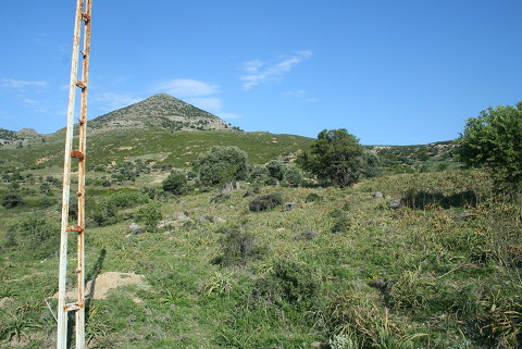
| Location: It lies on the western side of Gökçeada (Imroz); about 900 m east-northeast of Ugurlu village. The site has been truncated by the road which connects the village to the center. It is about 1400 m from Ugurlu harbor and 23-24 km from Gökçeada; the center of the island. The site does not have a local name; the villagers of Ugurlu call this area Zeytinli Mevkii. |
| Geography and Environment: The site has leaned against the eastern slope of Ayistrado Hill. There is a small stream to the north of the settlement; flowing in the north-south direction. According to the distribution of the ceramics; the settlement measures 300x100 m but the Neolithic Period pottery is scattered over an area of 100x100 m on the section facing the stream. The mound is about 1 m high and overlooks a wide cultivated valley. A drainage channel related to the Ugurlu pond; built by the State Hydraulic Works; has truncated the settlement in the north-south direction. On the profile of the ditch; which was caused by this destruction and still was not closed on September 1999; it can be observed that the mound is at least 2 m deep. Today the site is covered with sparse olive trees. |
| Destruction Details: It was visited by TAYEx Bizans Marmara in 2008 and it was found that no traces were left behind from the massive mound. The water canal and the road seriously harmed the mound [TAYEx 3.5.2008]. |