|
©The Archaeological Settlements of Turkey - TAY Project
|
|
|
|
|
|
Ugurlu / Zeytinli |
|
|
For site maps and drawings please click on the picture...  |
For photographs please click on the photo... 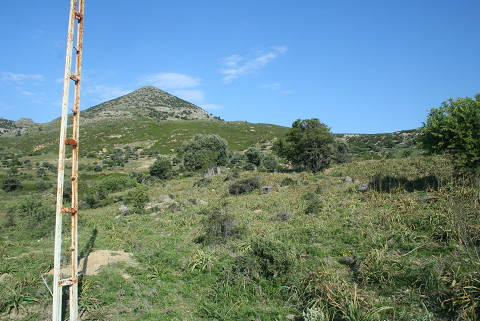 |
|
Type:
|
Mound |
|
Altitude:
|
0 m |
|
Region:
|
Marmara |
|
Province:
|
Çanakkale |
|
District:
|
Gökçeada |
|
Village:
|
Ugurlu |
|
Investigation Method:
|
Excavation |
|
Period:
|
|
|
|
|
 |
|
| Location: It lies on the western side of Gökçeada (Imroz); about 900 m east-northeast of Ugurlu village. The site has been truncated by the road which connects the village to the center. It is about 1400 m from Ugurlu harbor and 23-24 km from Gökçeada; the center of the island. The site does not have a local name; the villagers of Ugurlu call this area Zeytinli Mevkii. |
| Geography and Environment: The site has leaned against the eastern slope of Ayistrado Hill. There is a small stream to the north of the settlement; flowing in the north-south direction. According to the distribution of the ceramics; the settlement measures 300x100 m but the Neolithic Period pottery is scattered over an area of 100x100 m on the section facing the stream. The mound is about 1 m high and overlooks a wide cultivated valley. A drainage channel related to the Ugurlu pond; built by the State Hydraulic Works; has truncated the settlement in the north-south direction. On the profile of the ditch; which was caused by this destruction and still was not closed on September 1999; it can be observed that the mound is at least 2 m deep. Today the site is covered with sparse olive trees. |
| History: |
| Research and Excavation: The site was discovered in 1997 during a survey under the leadership of S. Harmankaya and was reinvestigated during the survey of Gökçeada in 1999. Collection was made on the surface of the mound and especially to the north of the motorway; on the soil taken from the drainage channel. It was visited during TAYEx Bizans Marmara in 2008, and sherds were frequently found on both sides of the road that leads to Ugurlu Village (TAYEx 2008). The mound is being excavated by Burçin Erdogu from University of Thrace since 2009 [Erdogu 2011:119]. |
| Stratigraphy: According to the material collected from the excavations started in 2009 it is understood that the settlement is inhabited between Late Neolithic-Early Chalcolithic and Middle or Late Chalcolithic Age according to Anatolian Chronology (according to Aegean Chronology Early, Middle or Late Neolithic) [Erdogu 2011:120]. The 2010 excavation campaign shows the presence of 5 main phases in the settlement. Phase I is represented by the pottery which was found in the trenches of O11, O10 and P11. Phase II is also identified by the trenches of O11, O10 and P11. The finds belonging to Phase III comes from Trench P5 which was excavated previous year. This phase represents the transition period between Neolithic and Chalcolithic. Phase IV and V are dated to Neolithic. In addition; Phase V is the earliest phase of Ugurlu-Zeytinlik settlement [Erdogu 2012:366-368]. |
| Small Finds: Architecture: In 2011, "Building 1" located in the trenches of O-P 10 and 11, which was exposed in 2011, was continued to be excavated. The building was fully exposed. Dated to Chalcolithic period, this building measures 5x5 m. The stone walls built in dry wall technique is preserved up to 30-40 cm high. The north wall was formed with double wall. The wall was collapsed due to an unknown reason and it was reinforced from the interior section and a straight line was formed. There is a stone brace in dimensions of 1.50x0.87 on the northwest corner of the building. Its south wall extends towards the east. In this damaged section, there was probably a door opening. The west wall extending in the north-south direction joins with a semi circular space. This semi circular space facing to the outside of the building was possibly used for storing. Located to the west of the building, there is a courtyard wall erected with large stones which surrounds Building 1 by forming an arch. 7 celts and chisel, 4 bracelet fragments made out of Spondylus shell, 11 bone tools, 2 stone spindle whorls, 1 clay sling, 2 stone beads, 5 pendants made out of Cerastoderma shell and 1 clay figurine head were found in situ in the building. Also 130 Murex (Muricidae) shells, ground stones, pestles were recovered. Trench P5 was extended to 5x10 m towards the north. In this extended area, a wall reaching in the north-south direction was exposed on the surface. This wall built with large stones in dry wall technique turns to the west and forms a small rectangular room by joining with another wall in the north-south direction. A round hearth with a dimension of 50x50 cm was found in the courtyard located just on the east of the walls. The floor of the hearth was paved with potsherds. Based on the finds recovered, these remains found on the surface of Trench P5 are contemporary with Building 1. Under the architectural remains found on the surface of Trench P5, 12 plastered pits and a damaged hearth dated to Neolithic-Chalcolithic transition period were exposed. The floors and interior sections of the pits were plastered with yellow soil. The depth and size of the pits vary. The deepest one is about 1 m and the biggest one measures about 1 m in dimension. These pits were initially used as silo. Then, these pits were used as garbage pits for potsherds, animal bones and large stones [Erdogu-Yücel 2013:187-188]. During the excavations conducted in Trench CC-DD19-20 in 2012, a structure named Building 3 was exposed. This multi-roomed building measures 9x8 m. It extends in the northeast-southwest direction. The east section of the building has been damaged due to agricultural activities. 4 rooms of the building could have been exposed so far. A part of the building remained in the unexcavated area. The room no.1, which is the largest one, measures about 3x6 m. The floor of the room was plastered with yellow colored soil. The door located to the northwest of the room reaches to another room or courtyard. In this section, a jamb, which was used for a wooden beam to support the ceiling, and a round platform formed by regular stones. The north wall, which is quite thin, was built wit a single row of stone. The room no.2 is located to the south of the room no.1. The room is entered through a door with a height of about 90 cm. This section of the building has been destructed. The room measures 2x6 m. The floor of which was plastered with yellow colored soil. The room no.3 and 4 are located to the west of the building. The room no.3, which is the smallest one, measures about 1.5x3 m and is accessible through a door with a height of about 90 cm. The room no.4 is entered from the room no.3 through a door with a height of 70 cm. It measures 2x3 m. A square shaped stone platform was found in the northeast corner of the room [Erdogu et al. 2014:205-206]. In 2013, a wall remnant extending in the east-west direction was found in the plan square O6. The structure, which is dated to Chalcolithic Period based on the finds, was named "Building 4". The inner dimension of the building is about 5.5x6 m. The east section of the building has been entirely damaged. The stone walls built in dry wall technique are 65 cm in thickness. A door opening was found on the south wall of the building. This door opening measures 90 cm in width. The building is entered through a small anteroom with a dimension of 1.40x1 m. A very large bucranium was found in this opening. It is believed that this bucranium was hanged on the wall. The partially preserved floor of the building is plastered with limey soil and painted in red. There is a niche with a width of 50 cm on the section in which the south and west walls meet [Erdogu 2015:168]. During the 2014 studies, a storage unit plastered with yellow earth with a dimension of 60x60 cm was found in Trench O5 that is dated to Chalcolithic Period (Phase III). This unit was carved into the floor of two plasted pits measuring 1x1 m and 1.20x1.30 m. These pits destroyed the floor. During the profile cleaning studies carried out on the southeast corner of Trench P6, a wall erected with regular stones was found. This wall preserved up to half a meter. A 1x15 m square was opened towards the south and it is found out that the wall is the corner wall of a large building. These building remains belonging to Chalcolithic Phase III have destroyed the Neolithic levels [Erdogu-Yücel 2016:196-197]. In 2015, the plan square BB14 and AA-BB14 was enlarged towards the walking path. Two adjacent buildings (Building 6 and 7) on this area were dated to the Phase II (4500-4300 BC). The walls of Building 6 were built in the drystone wall technique. The building has at least two building phases. The north wall was erected as double wall. The west wall, on the other hand, measures 40-45 m thick and has two phases. The south wall has an unusual character. It extends towards the east and was built with very small regular stones. The entrance of the building probably was here. It has a compacted earth floor. The east wall of Building 7 and Building 6 is shared. Building 7 has also a compacted earth floor. There is a platform measuring 2.10x0.80 m that is adjacent to the north wall of the building. The Q-P walking path dug 6 m long and Trench Q6 was opened. The building remains found in this trench were examined. On the top, the wall remains showing no particular plan belonging to Chalcolithic Phase II were exposed. The walls dated to Chalcolithic Phase III (5500-4300 BC) were found immediately below these walls. However, it is found out that the building was probably demolished due to a disaster and all of the stones were removed by the inhabitants of Phase II. Very large stones were placed on he foundations and then the wall was erected with neatly cut square or rectangular stones. The floor of the building was plastered with yellow colored clayey soil [Erdogu 2017:118, 120]. Pottery: The potsherds recovered from Building 1 are known from Kumtepe IA-Besik Sivritepe Culture in Western Anatolia [Erdogu-Yücel 2013:187-188]. The potsherds recovered from Building 3 have red mottled, black and gray colored surfaces. Lids, four footed vessels with ear-shaped lugs, box-shaped vessels and spurred handles were found. Impressed, incised and groove decoration were generally applied on our footed vessels with ear-shaped lugs and box-shaped vessels. In addition, spiral, meander, checkboard, lozenge and cross motifs were seen [Erdogu et al. 2014:206]. During the 2013 excavation studies, potsherds were recovered from the damaged sections and entrance of Building 4. These sherds are related to Kumtepe IA-Besik Sivritepe Chalcolithic Period dated to 5200-4500 BC [Erdogu 2015:168]. In 2015, an almost whole pot was found in situ on the floor of the pit exposed in Trench O5 [Erdogu-Yücel 2016:196]. In 2015, storage pots were found in Building 6. Pottery sherds were exposed in the building fill of Trench Q6 [Erdogu 2017:118, 120]. Clay: In 2013, 2 figurine fragments were found at the entrance of Building 4. One of these figurines shares similarities to the typical Balkanic figurines. It is with flat torso and large hip. The arms join on the chest. The other figurine is native to the island. It is in the same style with the ones found in previous seasons. It has flat torso and a socket for head [Erdogu 2015:168]. In 2015, a large figurine piece bearing a decoration was found in Trench Q6. [Erdogu 2017:120]. Chipped Stone: It was observed that the number of scrapers and borers increased in Phase III that is dated to Chalcolithic Period [Erdogu et al. 2014:207]. In 2015, a burnished stone axe was found in Building 7. Two obsidian bullet-shaped cores found in Chalcolithic Phase III are noteworthy. There are also flint bullet-shaped cores [Erdogu 2017:118,120]. Ground Stone: Inside the niche located in the section in which the south and west walls of Building 4 meet, about 40 sling stones and natural stones were found. This niche yielded a ground stone piece as well [Erdogu 2015:168]. During the 2015 studies, 4-5 ground stones, grinding stones, a perforated stone (buried into the floor) that was probably used as a mortar and pestles were recovered from Building 7 [Erdo_u 2017:118]. Chipped Stone: In 2015, a burnished stone axe was found in Building 7. Two obsidian bullet-shaped cores found in Chalcolithic Phase III are noteworthy. There are also flint bullet-shaped cores [Erdogu 2017:118,120]. Ground Stone: During the 2015 studies, 4-5 ground stones, grinding stones, a perforated stone (buried into the floor) that was probably used as a mortar and pestles were recovered from Building 7 [Erdogu 2017:118]. Bone / Antler: In 2014, a decorated bone spatula was found on the floors of the pits in Trench O5. Trench P6, on the other hand, yielded Spondylus shells and about 20 bracelet/ring pieces made out of Spondylus and Glycymeris and almost 100 piercing tools made of worked bone and flint [Erdogu-Yücel 2016:196-197]. In 2015, a few shell beads were recovered from Building 7. The 2014 and 2015 studies yielded about 100 bone tools. Most of them are awl and spatula [Erdogu 2017:119, 120]. Flora: In 2014, the studies carried out in Phase III dated to 5500-4800 BC yielded remains of Triticum timopheevi that is called "new type of glume wheat", barley (Hordeum sp.) and lentil (Lens sp.). Among the carbonized remains of fruits and nuts, there are fig (Ficus carica) and pistachio (Pistacia sp.). Triticum timopheevi is native in Caucasia. It is assumed that it originated in Turkey-Iranian border. This species was found in some Neolithic and Chalcolithic settlements in the north of Aegean [Erdogu-Yücel 2016:198]. |
| Remains: |
| Interpretation and Dating: The 14C analysis on the samples taken from Building 3 results the years between 5500-5300 BC. It was suggested that a local culture contemporary with the Early Vinca and Karanovo III (in the Balkans) existed in the island in this period [Erdogu et al. 2014:206]. |