|
©The Archaeological Settlements of Turkey - TAY Project
|
|
|
|
|
|
Ugurlu / Zeytinli |
|
|
For site maps and drawings please click on the picture...  |
For photographs please click on the photo... 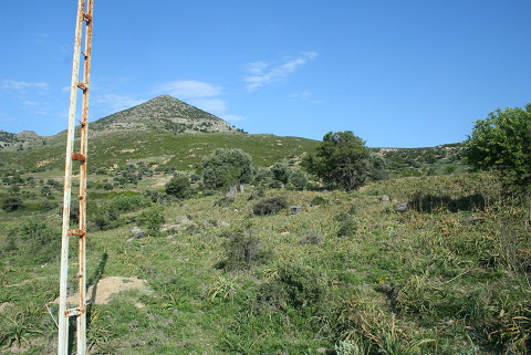 |
|
Type:
|
Mound |
|
Altitude:
|
0 m |
|
Region:
|
Marmara |
|
Province:
|
Çanakkale |
|
District:
|
Gökçeada |
|
Village:
|
Ugurlu |
|
Investigation Method:
|
Excavation |
|
Period:
|
EBA I |
|
|
|
 |
|
| It lies on the western side of Gökçeada (Imroz); about 900 m east-northeast of Ugurlu village. The site has been truncated by the road which connects the village to the center. It is about 1400 m from Ugurlu harbor and 23-24 km from Gökçeada; the center of the island. The site does not have a local name; the villagers of Ugurlu call this area Zeytinli Mevkii. It will not be influenced by the irrigation dam erected on the Balli Stream. It was discovered during a survey conducted under S. Harmankaya in 1997. The irrigation channel coming from the dam has partly destroyed the northern part of the settlement. In accordance with the distribution of pottery; it is suggested to measure 100x80 m in dimensions. The mound is located on the northern bank of a small stream; extending in terraces through the stream. It probably used to lay next to a bay. Sherds of the Neolithic; Early Chalcolithic and Early Bronze Ages were collected from the surface. It is a significant settlement of the island. It should have been excavated together with Yeni Bademli Höyük. It was visited during TAYEx Bizans Marmara in 2008 and sherds were frequently found on both sides of the road to Ugurlu Village (TAYEx 2008). |
| Location: It lies on the western side of Gökçeada (Imroz); about 900 m east-northeast of Ugurlu village. The site has been truncated by the road which connects the village to the center. It is about 1400 m from Ugurlu harbor and 23-24 km from Gökçeada; the center of the island. The site does not have a local name; the villagers of Ugurlu call this area Zeytinli Mevkii. |
| Geography and Environment: The site has leaned against the eastern slope of Ayistrado Hill. There is a small stream to the north of the settlement; flowing in the north-south direction. According to the distribution of the ceramics; the settlement measures 300x100 m but the Neolithic Period pottery is scattered over an area of 100x100 m on the section facing the stream. The mound is about 1 m high and overlooks a wide cultivated valley. A drainage channel related to the Ugurlu pond; built by the State Hydraulic Works; has truncated the settlement in the north-south direction. On the profile of the ditch; which was caused by this destruction and still was not closed on September 1999; it can be observed that the mound is at least 2 m deep. Today the site is covered with sparse olive trees. |
| History: |
| Research and Excavation: |
| Stratigraphy: |
| Small Finds: |
| Remains: |
| Interpretation and Dating: |