| ©The Archaeological Settlements of Turkey - TAY Project | ||||||
|
|
||||||
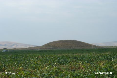
Topakhöyük |
||||||
|
|
||||||
| Ages | Maps | Photos | ||||
| Chalcolithic EBA |
 |
 |
||||
|
|
||||||
|
Type:
|
Mound | |||||
|
Altitude:
|
1130 m | |||||
|
Diameter:
|
110 m- Direction: N-S | |||||
|
|
||||||
|
Region:
|
Central Anatolia | |||||
|
Province:
|
Nevsehir | |||||
|
District:
|
Gülsehir | |||||
|
Village:
|
Ovaören | |||||
|
|
||||||
|
Destruction :
|
Illicit Digging - Agriculture | |||||
|
|
||||||
|
TAYEx:
|
Visited - 5/8/2002 | |||||
|
|
||||||
|
Registration State:
|
For detailed registration information please refer to Turkish pages. | |||||
 |
||||||
| Location: It is located west o Nevsehir Province at the city border toAksaray Province. It lies 2.7 km southeast of Ozancik Village; 3 km south of Ovaören Village; northeast of Aksaray Province; southwest of Gülsehir District. |
| Geography and Environment: Located 350 m west of Yassihöyük, Topakhöyük and Terrace Settlement cover an area of about 17 hectares [Senyurt et al. 2014:62]. |
| Destruction Details: The skirts of the mound are cultivated and there is a pit of illicit digging on south-southeast slope [TAYEx 5.8.2002]. |