|
©The Archaeological Settlements of Turkey - TAY Project
|
|
|
|
|
|
Topakhöyük |
|
|
For site maps and drawings please click on the picture...  |
For photographs please click on the photo... 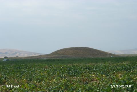 |
|
Type:
|
Mound |
|
Altitude:
|
1130 m |
|
Region:
|
Central Anatolia |
|
Province:
|
Nevsehir |
|
District:
|
Gülsehir |
|
Village:
|
Ovaören |
|
Investigation Method:
|
Excavation |
|
Period:
|
|
|
|
|
 |
|
| Location: It is located west o Nevsehir Province at the city border toAksaray Province. It lies 2.7 km southeast of Ozancik Village; 3 km south of Ovaören Village; northeast of Aksaray Province; southwest of Gülsehir District. |
| Geography and Environment: Located 350 m west of Yassihöyük, Topakhöyük and Terrace Settlement cover an area of about 17 hectares [Senyurt et al. 2014:62]. |
| History: |
| Research and Excavation: It was discovered by the Kaman Kalehöyük excavation team under S. Omura in 1996. It was revisited by S.Y. Senyurt in 1997 and indicated as within the territory of Nevsehir Province. The excavations were started within the frame of "Ovaören Archaeological Area" under the directorship of Y. Senyurt in 2007. |
| Stratigraphy: As a result of the 2012 campaign, 3 levels were defined. The potsherds recovered from Level I bear the characteristics of MBA period (Assyrian Trade Colonies Period). The potsherds belonging to Level II share similarities with the ones known from the southwest of Central Anatolia in the 2nd half of EBA III (2200-1950 BC). The majority of Level III wares consists of thick walled, red slipped Central Anatolian wares [Senyurt et al. 2014:68-69]. |
| Small Finds: Architecture: It is small mound with a diameter of 110 m and a height of 15 m. The Terrace Settlement extending on the south and northeast of the mound covers an area of 500x300 m. As the results of the excavations carried out in the stepped trench of Topakhöyük, it was found out that the upper section of the mound was occupied by the architectural remains of EBA III and MBA levels which have not been discovered yet. The cultural layer with its architectural remains discovered under the levels in question could be dated to EBA II based on a few small finds and potsherds found in large quantity. Among the finds recovered from the stepped trench, there are spindle whorls, fragment of a bronze dagger and vessels in various types [Senyurt et al. 2013:25]. The architectural remains of Level I and II, which were exposed just below the surface, have been damaged. The remains belonging to Level III consist of two structures that have different characteristics in terms of construction technique. The foundation of the structure, which was partially unearthed near the center of the mound, were formed with medium sized limestone blocks and small pebbles. The body of the structure was built with mud brick. It consists of two rooms. The second structure was separated from the first structure by a corridor with a width of about 1 m. The south wall of the structure was erected with quite large limestone blocks together with relatively smaller limestone blocks. It is about 1 m wide. The east wall, on the other hand, is 0.75 m in width [Senyurt et al. 2014:68]. In Terrace Settlement, in the Area A where the 2nd millennium BC levels were excavated in horizontal plan, 3 architectural phases were discovered. In Area B, the ground level was reached. It has been discovered that the cultural deposit belonging to the first level was represented by the garbage pits. Potsherds recovered from this area bear the similar characteristics with the ones found in Area A in Level I. Therefore, they are dated to MBA. The architectural remains of Level II consist of two stone foundations belonging to two different walls which their plan couldn't be identified. It is thought that potsherds of this level belong to EBA III. Cist graves were encountered at the foundation level of the walls belonging to Level II. It was observed that the graves were disturbed in the period which they belong to and filled with stones. Potsherd recovered from the graves show that they could have been used at the end of EBA II. Both of the graves measure 2 m in length and 1 m in width. Also, a pot burial which could be dated to EBA II was discovered. Two jar burials were exposed under the cist graves. The mouths of the jars were turned upside down and their bases were covered with limestone lids. The graves belonging to Level IV of the Terrace Settlement are dated to the beginning of EBA II or end of EBA I [Senyurt et al. 2013:25-26]. In 2013, the excavations were carried out in Trench GF-147 in Area A in order to explore the fills belonging to EBA. EBA III level was exposed below the pits dated to MBA in this area. This level has been entirely damaged due to the pits. In this level, only tankard sherds and wheel made plates were found. EBA II level was reached under this level. It is believed that this level had two phases. In the early phase, remains of a burnt building were partially exposed. The late phase is represented by rubbist pits cut the floor of the building belonging to the early phase. The potsherds, recovered from the level located below MBA level in Trench GT-137 in Area B, indicate EBA III. In Level EBA III (Level III), fragments of stones and a large rubbish pit were found. The depth of this rounded rubbish pit is 2.5 and it is 2 m in diameter. Remains of walls belonging to three different structures were exposed in level IV that is possibly dated to the beginning of EBA III. In the same trench, remains of two separate buildings and a water well belonging to Level V. The rounded water well measures about 70 cm in diameter. It was bonded with medium sized stones. It is revealed that when the well was out of use, it was filled with stones and blocked. Level VI yielded remains of wall. These walls built with medium sized stones form the corner of a room. Potsherds found in this area bear EBA II characteristics as in Level V [Senyurt et al. 2015]. The 2014 studies concentrated on the remains belonging to EBA III and Assyrian Trade Colonies Period. It is seen that the walls belonging to Level II were also used for the structures in Level III. This wall begins from Trench GT-137 and extends towars Trench GT-138 plan square 4-c. It measures about 8.5 m in length and 70 cm in width. In some parts, the height of the wall reaches up to 1 m. The pilasters extending in the northeast-southwest direction of this wall are noteworthy. This kind of pilaster was used as a main architectural feature in Central Anatolia, especially the centers such as Kültepe and Alisar. The fact that the vessels such as tankards and depata recovered from Level III supports the idea that the finds are dated to EBA III. The 2014 studies carried out in Trench GT-138, Level IV yielded the richest architectural details. The rooms having different functions were recovered from this level. These rooms show integrity with the ones recovered from Trench GT-137 in 2013. It is seen that these rooms have square-shaped arrangements. These arrangements were made by vertically placed limestone slabs, the north and east sides of which are flat. There is a long and narrow corridor in the second room and the jar buried into the floor of this room is noteworthy. The mouth is damaged and it is buried with compressed soil and small-sized stones up to its upper section. Considering a large number of pottery found in Level IV, it is seen that this level is the earliest level of EBA III of Terrace Settlement. The imported vessels like depas, tankard and Syrian bottle support this idea. In Trench GS-113, after the first level, EBA II was reached. A 3 m long wall extending in the northwest-southeast direction was found. To the south of the wall, 1 m wide door opening and in situ doorjamb show that this wall that was built with very large stones is the southwest wall of a room. This room yielded a hearth floor and a large limestone block (the center of which has a pit) that was used as a workshop. In addition to this, a corroded needle was found. The fact that no potsherds dated to EBA III were recovered from this trench suggests that the section up to the north of Terrace Settlement has not been settled and the EBA III settlement concentrated in the center and south sections. A test pit with a depth of 2 m was opened in Trench GI-124. A 1.5 m long wall was found in the cultural layer on the floor of the test pit. The gold necklace fragment found around this wall testifies that this section is dated to EBA III. Also, this necklace indicates the existence of noble graves like in Alacahöyük and it resembles the ones found in Eskiyapar and Troia EBA III levels. The fact that the similar spiral pendants were also found in the treasure of Troia shows that the connection with Western Anatolia during EBA III was strong [Senyurt et al. 2016:113-116]. |
| Remains: |
| Interpretation and Dating: |