| ©The Archaeological Settlements of Turkey - TAY Project | ||||||
|
|
||||||
Tilkitepe |
||||||
|
|
||||||
| Ages | Maps | Photos | ||||
| Chalcolithic EBA |
 |
 |
||||
|
|
||||||
|
Type:
|
Mound | |||||
|
Altitude:
|
1650 m | |||||
|
Diameter:
|
m- Direction: | |||||
|
|
||||||
|
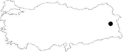
Region:
|
Eastern Anatolia | |||||
|
Province:
|
Van | |||||
|
District:
|
Merkez | |||||
|
Village:
|
Merkez | |||||
|
|
||||||
|
|
||||||
|
|
||||||
|
TAYEx:
|
Not visited - 4/7/2003 | |||||
|
|
||||||
|
Registration State:
|
For detailed registration information please refer to Turkish pages. | |||||
 |
||||||
| Location: The site lies 7 km southwest of Van; 4 km south of Van Castle; on Samramalti Plain partially used as an airport in the present; approximately 1 km from Van Lake; inside the borders of Van Airport. |
| Geography and Environment: The 6-7 m high mound; measuring 55 m in diameter; is reported to be damaged by the earlier buildings of the airport. It is small; ovoid; and 9-10 m high above the level of the lake. The first settlers are thought to have inhabited the area just near the lake. A closely fresh water spring was most probably used as the water source. However; there no springs or creeks around the site. |
| Destruction Details: The mound inside the field that belongs to DHMI (General Directorate of State Airports Authority) survived until present. The northwestern section of the mound was assigned for training by the Special Forces under the Internal Affairs Department of the Government of Turkey since 1987. Therefore during the mound surveys more cartridge bullets and hand grenade fuses were found than archaeological material. Afterwards a closed training building was constructed right next to Tilkitepe. The areas that were destructed after 2000 are: 1. An area was arranged to constitute a shooting gallery which covered approximately 2.000 m2. This way the part excavated by W. Belck in 1899 was destroyed. 2. The soil which was removed was then transported 100 m southwest of the mound and was spreaded. 3. Barrels were placed over the mound in east-west direction to provide a shield at the northern shooting gallery. 4. An exit gate was placed over the mound; on the western direction which faces the old airport buildings; which measures 5 m long and 3 m wide. It was apparently made by earthmoving machinery. 5. Later observations showed that illicit diggings were carried out at the same spot. 6. Another similar but larger destruction was observed on the soutjern slope. This is the southwestern elongation of the trench made by the lake couple in 1939. 7. An area of 5x5 m in size was dug on the eastern slope of the mound and it was surrounded by worn truck tires for manoeuvre purposes. 8. The mound slope was apparently leveled starting from the manoeuvre area towards the southern direction. This area was used for the storage of the removed soil from older excavations. 9. A metal closure right south of the Lake excavation area displays the cables installed at 2 m depth underground. The purpose or route of the cables is unknown. 10. The area excavated in the south of the mound by the Lake couple in 1939 is subject to small landslides on the edges which causes the land to fill the empty spaces inside the trench [Kılıç 2006:1-10]. |