| ©The Archaeological Settlements of Turkey - TAY Project | ||||||
|
|
||||||
Aziziye |
||||||
|
|
||||||
| Ages | Maps | Photos | ||||
| Neolithic Chalcolithic EBA |
 |
 |
||||
|
|
||||||
|
Type:
|
Mound | |||||
|
Altitude:
|
1220 m | |||||
|
Diameter:
|
m- Direction: | |||||
|
|
||||||
|
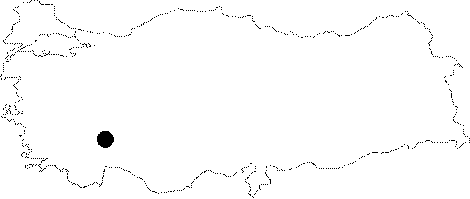
Region:
|
Mediterranean | |||||
|
Province:
|
Burdur | |||||
|
District:
|
Merkez | |||||
|
Village:
|
Aziziye | |||||
|
|
||||||
|
Destruction :
|
Illicit Digging - Agriculture | |||||
|
|
||||||
|
TAYEx:
|
Visited - 26/6/2001 | |||||
|
|
||||||
|
Registration State:
|
Registered For detailed registration information please refer to Turkish pages. | |||||
 |
||||||
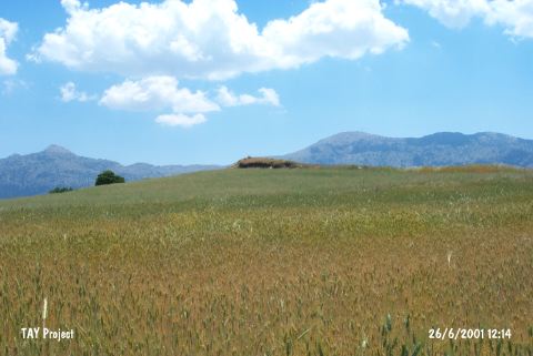
| Location: This site lies in Höyük Mevkii; 600 m west of Çamoluk (Aziziye-Sertaç) Village; south of the city of Burdur. It is also located 10 km south of Gölde and 2 km south of the village of Erikli. |
| Geography and Environment: This mound; which is 150x200 m in size; lies 1;100 m above sea level and 8 m above the level of the plain [Özsait 1989a:chart.XIV; fig. 5]. Kocademirli Stream; one of the branches of Elmacik Stream; flows south of the mound. The area has abundant sources of water. The mound lies in the Elmacik-Kozluca municipality along the Kocademirli-Elmacik highway. The surface of the mound has been plowed. |
| Destruction Details: The mound has been damaged de to agricultural activities and illicit diggings. Except the small area on top hill all of he site is cultivated. There is a pit extending north to south [TAYEx 26.6.2001]. |