|
©The Archaeological Settlements of Turkey - TAY Project
|
|
|
|
|
|
Aziziye |
|
|
For site maps and drawings please click on the picture... 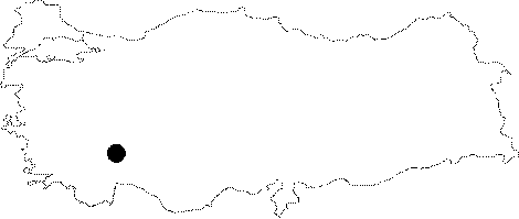 |
For photographs please click on the photo... 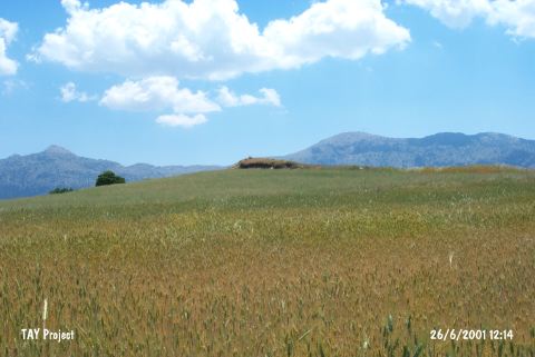 |
|
Type:
|
Mound |
|
Altitude:
|
1220 m |
|
Region:
|
Mediterranean |
|
Province:
|
Burdur |
|
District:
|
Merkez |
|
Village:
|
Aziziye |
|
Investigation Method:
|
Survey |
|
Period:
|
Early |
|
|
|
 |
|
| It lies on north bank of Kocademirli Stream; in Höyük Mevkii; 600 m west of Aziziye (Çamoluk-Sertaç) Village; south of the city of Burdur. It is also located 10 km south of Gölde and 2 km south of the village of Erikli. It is 8 m high; 200x150 m. According to M. Özsait; who discovered the site in 1983; the collected material consists of the typical sherds of Hacilar Late Neolithic Age-Early Chalcolithic Age phases. In addition there are sherds dating to the EBA. It takes place in the registered archaeological sites list prepared by Ministry of Culture and Tourism. |
| Location: This site lies in Höyük Mevkii; 600 m west of Çamoluk (Aziziye-Sertaç) Village; south of the city of Burdur. It is also located 10 km south of Gölde and 2 km south of the village of Erikli. |
| Geography and Environment: This mound; which is 150x200 m in size; lies 1;100 m above sea level and 8 m above the level of the plain [Özsait 1989a:chart.XIV; fig. 5]. Kocademirli Stream; one of the branches of Elmacik Stream; flows south of the mound. The area has abundant sources of water. The mound lies in the Elmacik-Kozluca municipality along the Kocademirli-Elmacik highway. The surface of the mound has been plowed. |
| History: |
| Research and Excavation: |
| Stratigraphy: |
| Small Finds: |
| Remains: |
| Interpretation and Dating: |