| ©The Archaeological Settlements of Turkey - TAY Project | ||||||
|
|
||||||
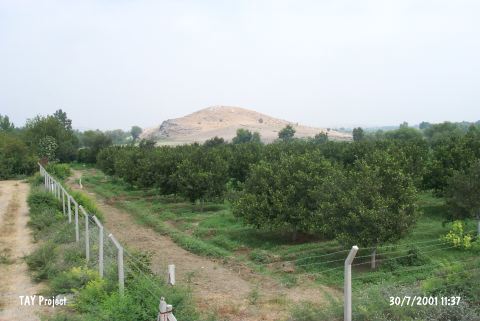
Tilan Hüyük |
||||||
|
|
||||||
| Ages | Maps | Photos | ||||
| Neolithic Chalcolithic EBA IA |
 |
 |
||||
|
|
||||||
|
Type:
|
Mound | |||||
|
Altitude:
|
90 m | |||||
|
Diameter:
|
m- Direction: | |||||
|
|
||||||
|
Region:
|
Mediterranean | |||||
|
Province:
|
Adana | |||||
|
District:
|
Kozan | |||||
|
Village:
|
Gökçeyol | |||||
|
|
||||||
|
|
||||||
|
|
||||||
|
TAYEx:
|
Visited - 30/7/2001 | |||||
|
|
||||||
|
Registration State:
|
For detailed registration information please refer to Turkish pages. | |||||
 |
||||||
| Location: The mound is located in Tilan Quarter of Gökçeyol Village; 2.4 km southeast of Torunlar Village; approximately 16 km southeast of Kozan District; northeast of Adana Province. |
| Geography and Environment: The mound; including the natural hill it lies on; is 40 m high. It is believed that the cultural deposits comprise 20 m. There is a village on one side of the site while on the other side of the site is Deli Stream. The mound is very large and terraced. The exact dimensions have not been provided. |
| Destruction Details: |