|
©The Archaeological Settlements of Turkey - TAY Project
|
|
|
|
|
|
Tilan Hüyük |
|
|
For site maps and drawings please click on the picture...  |
For photographs please click on the photo... 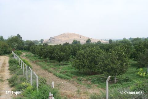 |
|
Type:
|
Mound |
|
Altitude:
|
90 m |
|
Region:
|
Mediterranean |
|
Province:
|
Adana |
|
District:
|
Kozan |
|
Village:
|
Gökçeyol |
|
Investigation Method:
|
Survey |
|
Period:
|
|
|
|
|
 |
|
| It is situated approximately 16 km southeast of the Kozan District in Adana. It seems that it has a particularly thick layer of cultural deposit from the Iron Age settlement. According to M.V. Seton-Williams who conducted a survey in Cilicia in 1951, red and black burnished ware that were collected are dated to the EBA. There are sherds dating from the Chalcolithic Age [Harmankaya et al. 1998:Tilan] until the Hellenistic Period [Seton-Williams 1954:131-171]. |
| Location: The mound is located in Tilan Quarter of Gökçeyol Village; 2.4 km southeast of Torunlar Village; approximately 16 km southeast of Kozan District; northeast of Adana Province. |
| Geography and Environment: The mound; including the natural hill it lies on; is 40 m high. It is believed that the cultural deposits comprise 20 m. There is a village on one side of the site while on the other side of the site is Deli Stream. The mound is very large and terraced. The exact dimensions have not been provided. |
| History: |
| Research and Excavation: |
| Stratigraphy: |
| Small Finds: |
| Remains: |
| Interpretation and Dating: |