|
©The Archaeological Settlements of Turkey - TAY Project
|
|
|
|
|
|
Tilan Hüyük |
|
|
For site maps and drawings please click on the picture... 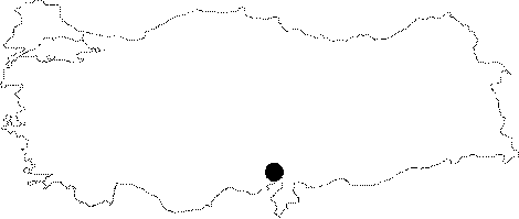 |
For photographs please click on the photo... 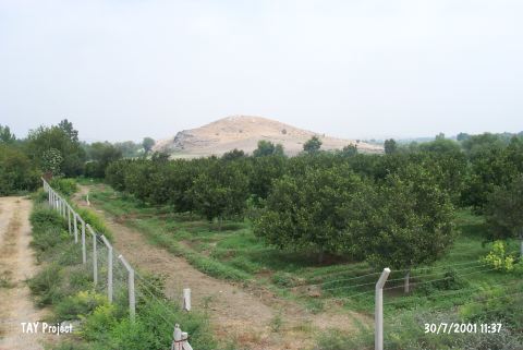 |
|
Type:
|
Mound |
|
Altitude:
|
90 m |
|
Region:
|
Mediterranean |
|
Province:
|
Adana |
|
District:
|
Kozan |
|
Village:
|
Gökçeyol |
|
Investigation Method:
|
Survey |
|
Period:
|
Ceramic |
|
|
|
 |
|
| Location: The mound is located in Tilan Quarter of Gökçeyol Village; 2.4 km southeast of Torunlar Village; approximately 16 km southeast of Kozan District; northeast of Adana Province. |
| Geography and Environment: The mound; including the natural hill it lies on; is 40 m high. It is believed that the cultural deposits comprise 20 m. There is a village on one side of the site while on the other side of the site is Deli Stream. The mound is very large and terraced. The exact dimensions have not been provided. |
| History: |
| Research and Excavation: The site was discovered in 1951 by M.V. Seton-Williams during the surface survey he conducted in Cilicia. |
| Stratigraphy: The ceramics collected during the surface survey suggest that the uppermost layer of the site is Roman. Beneath this is an Iron Age layer overlaying Late; Middle and Early Bronze Age and Chalcolithic layers. There may also be a Late Neolithic-Early Chalcolithic settlement at the site. |
| Small Finds: Pottery: The survey at Tilan Höyük yielded pre-Halaf early painted pottery [Seton-Williams 1954:130]. |
| Remains: |
| Interpretation and Dating: In this region painted pre-Halaf pottery has been found in the proto-Chalcolithic layer XXIV of the mound of Mersin Yumuktepe. The site has been placed in the sixth phase of ASPRO [Hours et al. 1994:341]. The Late Neolithic-Early Chalcolithic component at the site should be re-researched. Excavations at Mersin Yumuktepe will help answer some of the questions about this site. The publication provides no detailed information about the finds. |