| ©The Archaeological Settlements of Turkey - TAY Project | ||||||
|
|
||||||
Tell Kurdu |
||||||
|
|
||||||
| Ages | Maps | Photos | ||||
| Neolithic Chalcolithic EBA 14C |
 |
 |
||||
|
|
||||||
|
Type:
|
Mound | |||||
|
Altitude:
|
160 m | |||||
|
Diameter:
|
m- Direction: | |||||
|
|
||||||
|
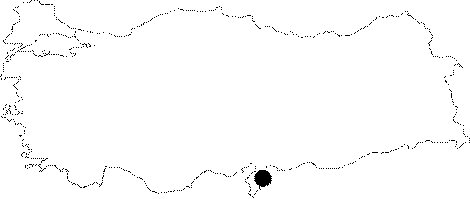
Region:
|
Mediterranean | |||||
|
Province:
|
Hatay | |||||
|
District:
|
Reyhanli | |||||
|
Village:
|
Kürttevekkeli | |||||
|
|
||||||
|
Destruction :
|
Agriculture | |||||
|
|
||||||
|
TAYEx:
|
Visited - 16/7/2001 | |||||
|
|
||||||
|
Registration State:
|
Registered For detailed registration information please refer to Turkish pages. | |||||
 |
||||||
| Location: The site lies northeast of Antakya; northwest of Reyhanli District; beneath the modern village of Kurttevekkeli (Tell Kurdu). |
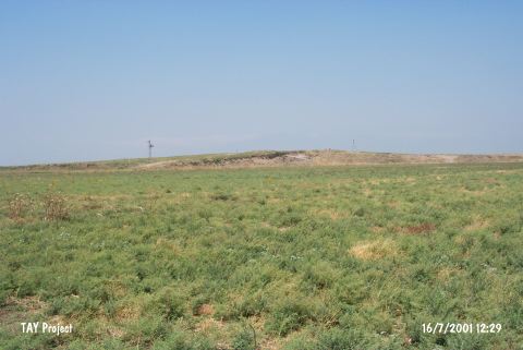
| Geography and Environment: Although the mound is big and flat; it does not have high and steep slopes. The debris at the southwest causes the mound to appear in the shape of a hump. 450x380 m mound was greatly damaged like the rest of the mounds in Reyhanli Region. Villagers have cut a triangular part of the mound to widen the cotton fields [Yener-Wilkinson 1997:414]. There are fertile fields around the site; which lies east of the lake. No fresh water spring is reported around the site. Because of extreme damage at the site; the Chicago Oriental Institute plans to conduct excavations. |
| Destruction Details: The surface of the settlement that consists of two mounds has been leveled for agriculture and the area between has been filled. The eastern and western parts of the southern hill has been cut [TAYEx 16.7.2001]. |