|
©The Archaeological Settlements of Turkey - TAY Project
|
|
|
|
|
|
Tell Kurdu |
|
|
For site maps and drawings please click on the picture...  |
For photographs please click on the photo... 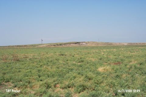 |
|
Type:
|
Mound |
|
Altitude:
|
160 m |
|
Region:
|
Mediterranean |
|
Province:
|
Hatay |
|
District:
|
Reyhanli |
|
Village:
|
Kürttevekkeli |
|
Investigation Method:
|
Excavation |
|
Period:
|
|
|
|
|
 |
|
| This site lies southeast of the city of Antakya; 13 km northwest of the town of Reyhanli; at the foot of the village of Tell Kurdu. The dimensions of the ceramic scatter on the mound is 450x380 m. The sides of the mound are very steep. The closest fresh water spring is 3.3 km east of the mound. The site was discovered by R.J. Braidwood in 1933 during his survey of the Amuq Plain. The mound yielded Tell el Cüdeyde/Judaidah Layer XIV; Dark Burnished Ware which has been assigned to the Neolithic. Although excavations at Tell Kurdu did not reach this level; the surface finds suggests that the ceramics at the site have Amuq A and B affinities. It takes place in the registered archaeological sites list prepared by Ministry of Culture and Tourism. |
| Location: The site lies northeast of Antakya; northwest of Reyhanli District; beneath the modern village of Kurttevekkeli (Tell Kurdu). |
| Geography and Environment: Although the mound is big and flat; it does not have high and steep slopes. The debris at the southwest causes the mound to appear in the shape of a hump. 450x380 m mound was greatly damaged like the rest of the mounds in Reyhanli Region. Villagers have cut a triangular part of the mound to widen the cotton fields [Yener-Wilkinson 1997:414]. There are fertile fields around the site; which lies east of the lake. No fresh water spring is reported around the site. Because of extreme damage at the site; the Chicago Oriental Institute plans to conduct excavations. |
| History: |
| Research and Excavation: |
| Stratigraphy: |
| Small Finds: |
| Remains: |
| Interpretation and Dating: |