| ©The Archaeological Settlements of Turkey - TAY Project | ||||||
|
|
||||||
Surtepe |
||||||
|
|
||||||
| Ages | Maps | Photos | ||||
| Chalcolithic EBA IA |
 |
 |
||||
|
|
||||||
|
Type:
|
Mound | |||||
|
Altitude:
|
490 m | |||||
|
Diameter:
|
m- Direction: | |||||
|
|
||||||
|
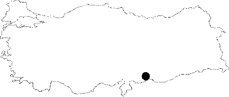
Region:
|
Southeastern Anatolia | |||||
|
Province:
|
Sanliurfa | |||||
|
District:
|
Birecik | |||||
|
Village:
|
Surtepe | |||||
|
|
||||||
|
Destruction :
|
Natural causes - Contemporary Settlements - Highways, roads, bridges etc. - Attention | |||||
|
|
||||||
|
TAYEx:
|
Visited - 16/8/2001 | |||||
|
|
||||||
|
Registration State:
|
Registered For detailed registration information please refer to Turkish pages. | |||||
 |
||||||
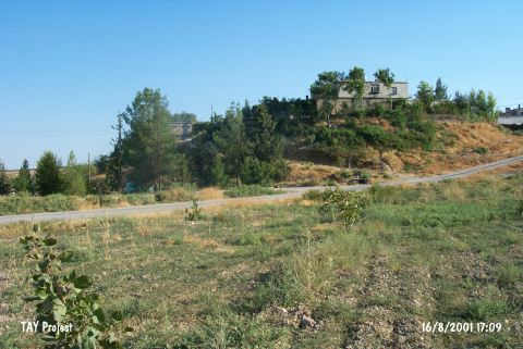
| Location: The mound lies west of Sanliurfa; northwest of Birecik; on north bank of Euphrates; in Surtepe village. |
| Geography and Environment: It covers a total area of 7.2 hectares and measures 250x230 m including the terraces. The cone of the mound has a height of 16 m and a diameter of 120 m. Based on the studies the occupied area of the mound could be from 20 to 50 hectares. The houses of Surtepe village were built over the mound and its eastern and southeastern foots were eroded by the river. The secondary village road has cut the northern and western slopes. |
| Destruction Details: There is corrosion on eastern; southeastern skirts of the mound; which is completely under the village houses and the western and northern skirts are cut by a road [TAYEx 16.8.2001]. |