|
©The Archaeological Settlements of Turkey - TAY Project
|
|
|
|
|
|
Surtepe |
|
|
For site maps and drawings please click on the picture... 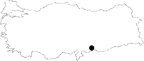 |
For photographs please click on the photo... 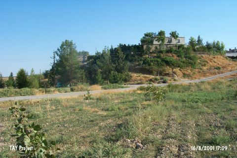 |
|
Type:
|
Mound |
|
Altitude:
|
490 m |
|
Region:
|
Southeastern Anatolia |
|
Province:
|
Sanliurfa |
|
District:
|
Birecik |
|
Village:
|
Surtepe |
|
Investigation Method:
|
Excavation |
|
Period:
|
Middle Late |
|
|
|
 |
|
| Location: The mound lies west of Sanliurfa; northwest of Birecik; on north bank of Euphrates; in Surtepe village. |
| Geography and Environment: It covers a total area of 7.2 hectares and measures 250x230 m including the terraces. The cone of the mound has a height of 16 m and a diameter of 120 m. Based on the studies the occupied area of the mound could be from 20 to 50 hectares. The houses of Surtepe village were built over the mound and its eastern and southeastern foots were eroded by the river. The secondary village road has cut the northern and western slopes. |
| History: |
| Research and Excavation: It is discovered by Algaze's team during the 1989 survey within the area that is to be inundated by Birecik Dam. Salvage excavations were carried out in 2000-2001 by the joint team of the Spanish Archaeological Mission in Turkey/University of Alicante; Later Prehistory Section; Spain; and in coordination with the museum of Sanliurfa; and the Oriental Institute and Academy of Science; Prague; Czech Republic. It takes place in the registered archaeological sites list prepared by Ministry of Culture and Tourism. |
| Stratigraphy: In 2000 excavations; Middle Chalcolithic/Ubaid; Late Chalcolithic and Early Bronze remains were reached. Surtepe seems to be occupied during the Halaf period; at least on the northern part of the mound. The site has yielded a long sequence of fourth millennium BC Late Chalcolithic levels. The site also includes levels of the Late Iron Age/Achaemenid Period. |
| Small Finds: Architecture: Monumental architecture dating to the Late Chalcolithic has been recovered. In the southern trenches large wall foundations were found. Trench E1 has shown a few rebuilding phases of either mudbrick or stone walls. According to the geological research; the river flooded the site sometime in the Late Chalcolithic. In square B3; a well preserved; probably monumental mudbrick structure was found. A stack of 60 unbaked mudbricks were found at the foot of the mudbrick platform. The platform extends at least 10 m. in depth. Another similar structure was found in central area of the site [Fuensanta et al. 2002:198;199]. In 2001; the excavation was concentrated on the B3 area. The tower or the high platform has shown continuity at least towards the east and the south. This architectural feature was build of mudbrick; of the same standardized size; 40x40 cm. The structure does not seem to be a city wall because a similar character of high platforms of towers was observed at Hazna in Syria and Tilbesar and Hacinebi in Anatolia. For now; it is suggested to be a monumental structure. In the southern part; the research was continued on the big platform. This platform is also made of 40x40 cm bricks. It was disturbed by some pits or round stone structures of later date; possibly EBA II and III [Fuensanta et al. 2003:107]. In 2005 work took place in three operations on the south side of the site, including a step trench to find bedrock. The earliest finds belonged to the Late Chalcolithic period and consisted of Late Uruk house foundations, bitumen painted pottery, a jar fragment with Late Uruk seal impression and two cylinder seals with typical Uruk scenes involving warfare. As at Tilbes Höyük, Late/Terminal Ubaid elements were identified in these deposits. Above the Late Chalcolithic levels was a thick ash layer and then EB levels [http://www.une.edu.au/cat/sites/surtepe.php, 22.6.2011; 14:47]. Pottery: Some painted Halaf sherds were noted. Late Chalcolithic levels contain a large sample of ceramics dated to the time of the so-called Uruk Expansion. Earliest layers containing the Ubaid type materials were accessed during 2005 excavations; that were to relocate Late Chalcolithic 1 or 2 based on the new hypothesis. The main reference in the dating was the painted jar styles; and similar. The earliest of the Late Chalcolithic jars of Surtepe were well oven-dried; and contained sand. The colors differ from creme to green. The paint is sometimes single tone; black or red. The forms are usually bowl; or middle size bowls; and sometimes large jars or small pots [Fuensanta et al. 2007:459-460]. The latest layers of the researched area revealed materials between Late Chalcolithic 3 to 5. Some types of Uruk extent pottery (usually grey; or red line drawn; beveled sided bowls; side spouted jars) were found [Fuensanta et al. 2007:461]. Clay: The fragment of a terracotta model in origin depicting several buildings; including a representation of a ziggurat. This model was made of fine ware and is associated with Late Uruk material. |
| Remains: |
| Interpretation and Dating: The Late Chalcolithic materials at Surtepe show some similarities with nearby site Tilbes. The Middle and Late Chalcolithic periods seem to have contained architectural features with some public and presumably important functions. It is believed that the Late Chalcolithic and the EBA I strata will contribute to the understanding of the northern Mesopotamian societies and the relations with the southern Mesopotamians. It may be stated that according to the new data the Uruk extent of Surtepe Höyük contains two main periods. 1) Middle Uruk period of Southern Mesopotamia (Late Chalcolithic 3-4); 2) Late Uruk Period (Late Chalcolithic 5) [Fuensanta et al. 2007:461]. |