| ©The Archaeological Settlements of Turkey - TAY Project | ||||||
|
|
||||||
Poskoflu / Yazidere |
||||||
|
|
||||||
| Ages | Maps | Photos | ||||
| Chalcolithic EBA |
 |
 |
||||
|
|
||||||
|
Type:
|
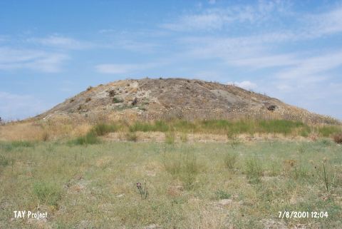
Mound | |||||
|
Altitude:
|
1170 m | |||||
|
Diameter:
|
m- Direction: | |||||
|
|
||||||
|
Region:
|
Eastern Anatolia | |||||
|
Province:
|
Kahramanmaras | |||||
|
District:
|
Afsin | |||||
|
Village:
|
Yazidere | |||||
|
|
||||||
|
Destruction :
|
Agriculture - Attention | |||||
|
|
||||||
|
TAYEx:
|
Visited - 7/8/2001 | |||||
|
|
||||||
|
Registration State:
|
For detailed registration information please refer to Turkish pages. | |||||
 |
||||||
| Location: |
| Geography and Environment: |
| Destruction Details: The top of the mound has been leveled due to agricultural activities. There are pits of illicit diggings on eastern and southern skirts. One of the pits has been excavated as a tunnel and it has such dimensions that one man can easily walk through to the center of the mound [TAYEx 7.8.2001]. |