|
©The Archaeological Settlements of Turkey - TAY Project
|
|
|
|
|
|
Poskoflu / Yazidere |
|
|
For site maps and drawings please click on the picture...  |
For photographs please click on the photo... 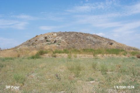 |
|
Type:
|
Mound |
|
Altitude:
|
1170 m |
|
Region:
|
Eastern Anatolia |
|
Province:
|
Kahramanmaras |
|
District:
|
Afsin |
|
Village:
|
Yazidere |
|
Investigation Method:
|
Survey |
|
Period:
|
Late |
|
|
|
 |
|
| The mound lies north of Kahramanmaras; southwest of Elbistan district; approximately 1 km west of Yazidere (Poskoflu) village. The mound on the north bank of Göksun Su stream and Mount Berit is partially destructed as a result of the villagers' gathering the stones from the mound for constructing their houses. Architectural remains are observed at the skirts of the flat mound with a height of 10 m and a diameter of 80-100 m. Late Chalcolithic Age plain ware and orange colored fine ware sherds are collected from the surface in 1962 by G.H. Brown. Other finds date to the following cultural horizons: EBA; MBA-LBA; IA; and Roman Period. |
| Location: |
| Geography and Environment: |
| History: |
| Research and Excavation: |
| Stratigraphy: |
| Small Finds: |
| Remains: |
| Interpretation and Dating: |