|
©The Archaeological Settlements of Turkey - TAY Project
|
|
|
|
|
|
Poskoflu / Yazidere |
|
|
For site maps and drawings please click on the picture...  |
For photographs please click on the photo... 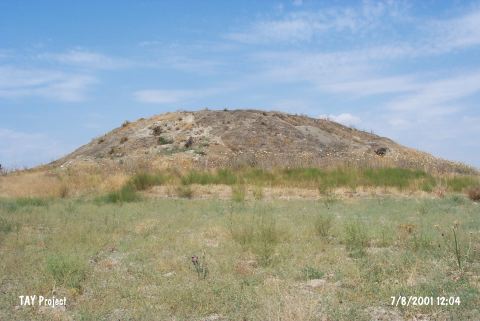 |
|
Type:
|
Mound |
|
Altitude:
|
1170 m |
|
Region:
|
Eastern Anatolia |
|
Province:
|
Kahramanmaras |
|
District:
|
Afsin |
|
Village:
|
Yazidere |
|
Investigation Method:
|
Survey |
|
Period:
|
|
|
|
|
 |
|
| It lies on the northern bank of the Göksun Stream; 1 km west of Yazidere (Poskoflu) Village; southeast of Afsin; south of Kahramanmaras Province. It measures 20 m in height and some 80-100 m in diameter. It has been severely damaged due to removal of the stones. During a survey conducted on the top hill and foothill in 1962; sherds of the eastern ware; the black rimmed ware; the coarse red; mottled washed ware dating from the EBA and the Cappadocian-like or known as imitation of Cappadocia ware were recovered. It is cited as Poskulu in some publications. |
| Location: |
| Geography and Environment: |
| History: |
| Research and Excavation: |
| Stratigraphy: |
| Small Finds: |
| Remains: |
| Interpretation and Dating: |