| ©The Archaeological Settlements of Turkey - TAY Project | ||||||
|
|
||||||
Aracaklar / Ariçiklar |
||||||
|
|
||||||
| Ages | Maps | Photos | ||||
| EBA IA |
 |
 |
||||
|
|
||||||
|
Type:
|
Mound | |||||
|
Altitude:
|
677 m | |||||
|
Diameter:
|
m- Direction: | |||||
|
|
||||||
|
Region:
|
Marmara | |||||
|
Province:
|
Bilecik | |||||
|
District:
|
Gölpazari | |||||
|
Village:
|
Aricaklar | |||||
|
|
||||||
|
Destruction :
|
Agriculture | |||||
|
|
||||||
|
TAYEx:
|
Visited - 14/7/2000 | |||||
|
|
||||||
|
Registration State:
|
For detailed registration information please refer to Turkish pages. | |||||
 |
||||||
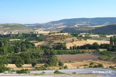
| Location: |
| Geography and Environment: |
| Destruction Details: The skirts of the mound have been cut to make fields. The upper part has also been leveled for cultivation [TAYEx 14.7.2000]. |