| ©The Archaeological Settlements of Turkey - TAY Project | ||||||
|
|
||||||
 |
Pedasa |
|||||
|
|
||||||
| Ages | Maps | Photos | ||||
| IA Greek-Roman |
 |
 |
||||
|
|
||||||
|
Type:
|
City | |||||
|
Altitude:
|
m | |||||
|
Diameter:
|
m- Direction: | |||||
|
|
||||||
|
Region:
|
Aegean | |||||
|
Province:
|
Mugla | |||||
|
District:
|
Milas | |||||
|
Village:
|
Gökçeler | |||||
|
|
||||||
|
|
||||||
|
|
||||||
|
TAYEx:
|
- | |||||
|
|
||||||
|
Registration State:
|
For detailed registration information please refer to Turkish pages. | |||||
  |
||||||
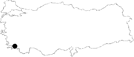
| Location: It is located in the Gokceler Village to the north of the Bodrum District of the Mugla Province [Bean 2000:115-116]. It is close to the village of Cirkan [Bean-Cook 1955:123]. |
| Geography and Environment: Situated in front of a narrow passage; it is reported to have been covered with pine trees during the researches carried out at the mid-20th century [Bean 2000:116]. The area stretching from the north of Goktepe and Konacik to the Torba port was presumably within the borders of the ancient city of Pedasa. Many Lelegian structures were found during the researches [Diler 2003:14-15]. |
| Destruction Details: |

